Tag Archives: evergreen

Holly Oaks


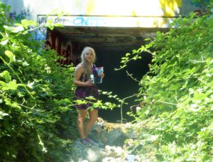
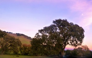
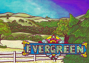
graffiti evergreenEvergreen is densely packed with big, hundreds of years old trees that stay green year round.  That’s the whole reason for the name.  That and Oakland was already taken.  Oak trees are the majority of this wooded grassland we call home.  I’ve tried to think like an oak tree, be an oak tree and even worn my hair kinky like an oak tree.  Upon my research, it would seem so ordinary to have just one or two kinds of oak species in an area this large, not 5-10 like we actually have.  It’s why there’s a place just outside of Evergreen that UC Berkeley studies the oak trees.  Today, I’ve picked the most festive of the oaks to focus on.

holly

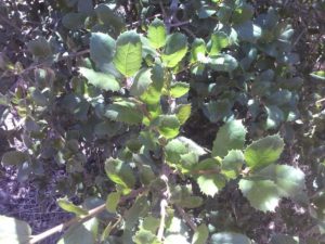
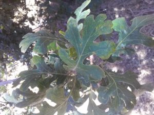
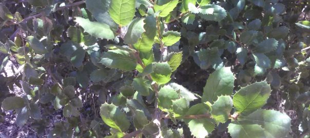
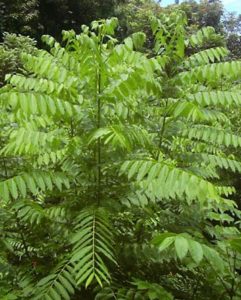
CAM11524CAM11520Holly Oak, the species, is named for its Holly-like leaves and branches, despite its other connotations.  Holly means magical, like Hollywood (with “wood” attached like Norwood).  It doesn’t have the regular oak leaves like to the right, but pointy ones.  The branches weren’t knotty and kinked like other oaks.  This is the leaf formation to the left, a typical Coastal Oak to the right, and a wide shot of the same young Holly Oak tree down below.  We see these in Evergreen all the time, especially along our creeks.

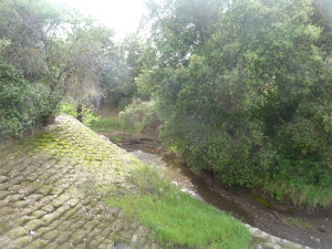
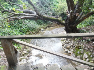
CAM11525P1310608This tree lines and shades the creek bed along Thompson Creek, also known as Dry Creek on historic maps, and around the school which is named for it.  I went to afterschool camp here as a youngster and thought this was what an oak tree was, with its pointy leaves and elongated acorns.  I also found it amongst other indigenous oaks and laurels by Silver Creek Linear Park and what is Silver Creek, the Creek.

CAM11530Neat trick and historian note: I can take a tape measure to trees and guesstimate an age, but I know any tree I can’t hug completely and touch my fingers is over 100 years old.  I have a wing span of 5.25 ft., I’m approximately a perfect Vitruvian Square like everyone else.  You too ought to be able to guesstimate the age of the trees.  Just give them a hug.


Silver Creek – the Creek

P1100107 (2)How else do we learn about our creek beds and their healthy or climate than taking a look at them up close and personally?  I ventured into our creek beds which gave me an awesome understanding of our fair Evergreen.  Today, we’re going to discuss a creek bed which is the namesake for the Western region of Evergreen between its namesake and Coyote Creek.

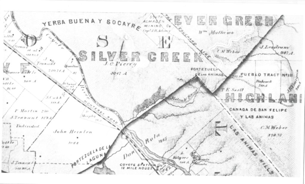
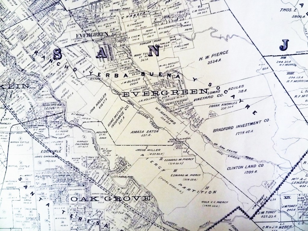
a 1876 map

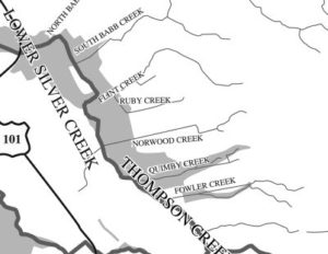
watershedThat’s right.  I’m talking about Silver Creek.  I went to Silver Creek High School, built in 1969, and never once wondered why the name.  When I first started this project, it appeared that Silver Creek was an important part of Evergreen’s story.  Farmers with land attached to creeks had the upper hand.  Before Silver Creek, the area, was an idea, the creek was there and Cunningham Lake was named Silver Lake.  This creek must’ve been so large, it contributed to the naming of the region.  In fact, the whole network of creeks through Evergreen contribute to the Lower Silver Creek Watershed.

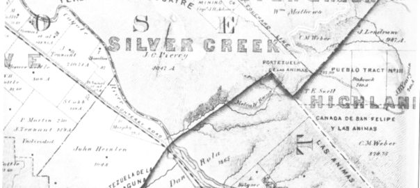
mapSilver Creek, as in the neighborhood and Evergreen’s first high school, has beenlocated on maps at least into the 1860’s.  Silver Creek, the area and the Creek, are historic.  This 1867 Altas shows it off predominantly.  It’s 2 miles outside of Downtown Evergreen, located off San Felipe Road and Evergreen Road.  It might’ve grown up as a town had stores not opened in nearby Township of Evergreen.  Because of its closeness to Edenvale and Downtown San Jose, it was incorporated into the City Limits earlier than Downtown Evergreen.  Evergreen is the entire Rancho Yerba Buena.  This area too being so far West would’ve been settled pretty early on by squatters.  Some of the defendants in the Chaboya case from these area specifically were the Cottle Family.

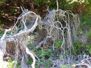
13415435_10206847123792679_6986196633091196421_oEvergreen was a haven for farmers because of its creeks and natural water delivery system in gravity, hillsides and natural springs throughout Evergreen.  Springs will appear whenever seismic activity is taking place, like Silver Creek and the Silver Creek Mines behind Silver Creek Valley Country Club.  Oak Trees and wild berries line the creek bed, with poppies, wild lupin and grasses around the surrounding hills.  These Oaks are Coastal Live Oak for the most part, even though Evergreen hosts a wide variety of oak trees.  An illness makes oak trees white like this.  It’s called root canker.  Amongst the spectrum of oak diseases, Silver Creek’s oaks are really looking pretty good.

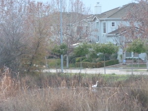
P1300931Silver Creek’s ecosystem is fairly healthy, as indigenous birds and wildlife still call it home.  Silver Creek’s existing water formations are very clean and free from pollutants.  When I examine this Creek, the only littering I see is on road ways nearby – not in the water itself.  Here, by Silver Creek Linear Park where Silver Creek appears to end, the Cottle’s cobble stone walls along the Dove Hill border are still evident.

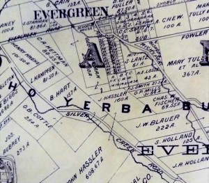
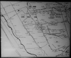
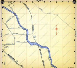
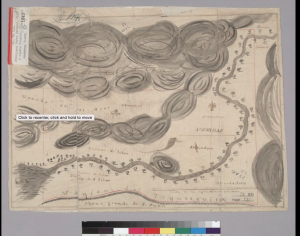
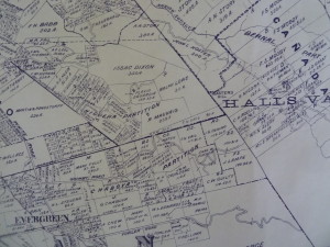
P1310192Silver Creek Road, King Road, White Road, Quimby Road and Evergreen Road back in those days were the huge arteries into Evergreen.  You can see in this enlargement to the left that Silver Creek Road and the Creek intertwined through modern day “the Ranch” development over Hassler Parkway.  Below you can view the entire length of the creek and roads.  Where Silver Creek Road straightens out has always transitioned to King Road.  King Road would’ve been the way to get to Downtown.  Kinda still is.

P1310197

CAM09459Silver Creek had its own grammar school at one point too.  I couldn’t find it on an atlas map, but Evergreen historian and trusted source, Colleen Cortese, has it closer to Coyote Creek than Silver Creek, but hey.  It served this whole area.

Silver Creek Road picks up again today near a Spring that contributes to Silver Creek’s Watershed.  Springs are created by the geology in the surrounding areas, not the gathering of water heading down the slope like lots of Evergreen’s creeks.

CAM10914

Drawing by Colleen Cortese

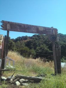
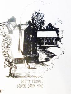
Silver Creek Mines are also located off of this portion of Silver Creek Road.  You can see North Almaden Mines here in this 1890 map above.  This same road used to connect over the hillside before its development.  Bradford Investment was involved with the Mining Industry in those days, establishing Silver Creek Mines, and would’ve built this road through to his jobsite.    You can see the entrance off San Felipe Road.  The Hellyers and Piercys too would’ve mined in Silver Creek region.  Brothers George and Daniel would choose opposite sides of Coyote Creek along the border with Edenvale, another small township.  Coyote Creek creates the western most point of Silver Creek and therefore Evergreen.  There’s a wicked rumor that someone accidently contaminated the Creek with quicksilver and their orchard turned to silver.  This may or may not have happen to oak trees in the area.

silver creek mapUntil Silver Creek High School opened, students had to travel outside of Evergreen to go to school.  The Creek would’ve existed where 101 lies now near the school.  Many sections of Silver Creek, the Creek and the Road, have been paved over for the 101 Freeway in the 1930-40’s and built on top of for Silver Creek Valley Country Club’s construction in the 1990’s.  Silver Creek Road which once followed the creek’s path also met up with San Felipe Road in the early 1900’s.

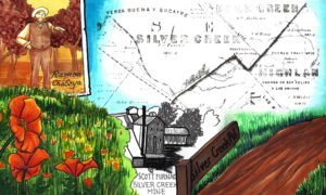
Silver Creek is a giant chunk of Evergreen, like a third.  It’s presence influenced people to settle in and raise their farms and families here.  Silver Creek is older than any Country Club, Park, or School.   All this time, I thought it just described nearby Dry Creek / Thomspon Creek when this was the larger watershed hooked up to Silver Lake or now Cunningham.  Here’s the Artwork featuring Silver Creek.

18951969


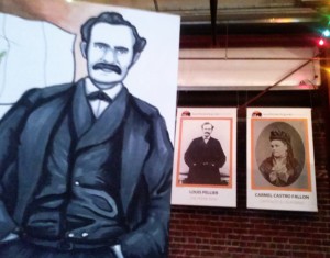
RIP – Louis Pellier

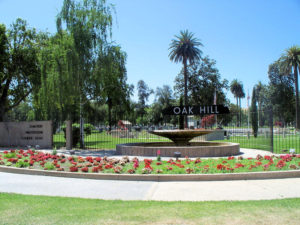
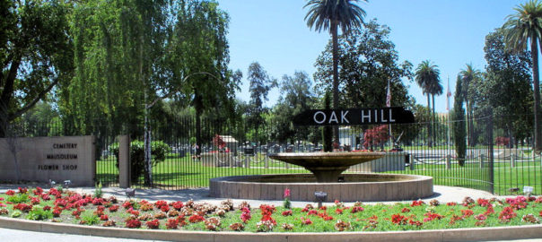
CEM47024782_124197784496When I went down to Oak Hill Cemetery on Fathers’ Day, because people lessen the likelihood of zombie apocalypse.  I was totally interested in anything Evergreen but they were scattered all over the place.  The only way to do this is wander around for a long time or check in the records people.  I’m going to have to dissect things into lawns and comb through records to find everyone.

That having been said, I knew there were some Pelliers buried here.  I forgot who initially was there, knowing it wasn’t the entire family.  In looking into the Pellier family originally, I also heard about this awesome grave discovery.  There was something fishy with the Louis Pellier headstones, but it looks weird to google on your phone and tip toe through a crowded graveyard.  Truth is Louis would and wouldn’t be here at Oak Hill Cemetery.

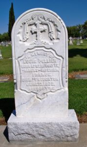
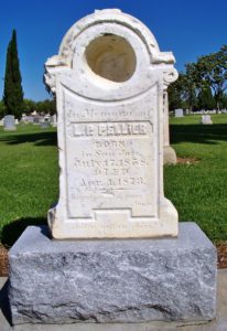
12314282_198416020500512_5584157587879954674_oSo, let’s start with our three Pellier brothers, the first generation to come to America.  The elder Pelliers were Louis, Pierre and Jean.  Louis A. Pellier was the brother who first came to America during the Gold Rush and first thought to bring the Prune and other fruit varietals to California soil.  His idea contributed to the California Fruit Industry we still enjoy today.  Louis Pellier would die in 1872, age the age of 55.  The eldest Louis Pellier wouldn’t be found at Oak Hill.  For a long while, his remains wouldn’t be found at all.

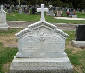
120013655_138395571327Interior-FirstGeneration-PierrePellierPierre would buy Pellier Ranch in Evergreen from his older brother, Louis, in 1863 after running someone else’s vineyards successfully near Mission San Jose.  Pierre and Henrietta Pellier raised their son and three daughters on their Evergreen ranch,  Although initially buried with his other relatives, Pierre Pellier would be buried at Oak Hill Cemetry.  I found he and his wife, Henrietta!  Wait. That’s a weird thing to get excited about.  I think this monument is stellar, though.  Again, weird thing to get excited about.

9ee89fc729d94679e4a4e7792a02a795Pellier’s son, Louis P. Pellier, would have been the patriarch once Pierre and Jean died.  Louis P. was being groomed to groom the vines and run the lucrative family business.  Louis P. Pellier would died at the age of 15 in 1873.  Passing a year after his uncle, the Pellier family was devastated.  They had no scions in the way of male heirs.  That having been said, his sisters stepped up and carried on the tradition of French Winemaking in the Evergreen hillside that eventually became the Mirassou Wine Dynasty.  The teenage

PelliWait, how did that happen?  They can’t get up and walk away.  Well, these Pelliers were laid to rest at Holy Cross or Kell Cemetery, opposite Communication Hill, on the outskirts of Willow Glen.  Here, for the most part patrons of St. Joseph’s Basilica were buried.  This included many notable Evergreenians.  Holy Cross Cemetery was sanctioned by the Catholic Church and operated from 1871-1890.  It was later replaced by a larger Catholic cemetery in 1882 which was closer to both Catholic churches.  Oak Hill Cemetery, close by, and Santa Clara Mission Cemetery was also available for Catholics.  In fact, many moved their loved ones to these other cemeteries.  The burial ground wasn’t maintained in the meantime and things got ran down.  Kids would play with things.  Earth would move.  Kell Cemetery was forgotten.  Today, it’s a source of Socio-Historic information for Archeologists.

In 1930, the unmoved graves would be bulldozed through and cleared for grazing land.  I spoke to the gentlemen who united the monuments with the remains, Ralph Pearce and Judge Paul Bernal.  For some reason the elder Louis’s headstone would go missing 80 years, rescued by Clyde Arbuckle, San Jose Historian.  Judge Paul Bernal describes its discovery by Clyde.

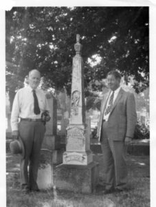
129607541_1399786781“Around 1941 historian Clyde Arbuckle was at the Holy Cross Cemetery with his two children Jim and Susan.    As Jim and Susan chased a jackrabbit across the once cemetery, Clyde discovered the broken headstone of Louis Pellier lying face-down in the brush.   There are photos of Clyde and Helen Abuckle with the headstone propped back up in the cemetery in 1948/1949.  Between 1948/1949 and 1951, Arbuckle removed the headstone for safekeeping.”

arbuckleClyde Arbuckle would realize the treasure he had found.  The grand headstone was used as a prop for a documentary on Sunsweet Prunes in 1951.  Arbuckle’s collection was just underway.  He would be San Jose’s prevailing historian for many years.  The Prune King’s monument would be a piece of a vast collection which became the awesome organization History San Jose.  I’ve visited these guys.  Wow.  If you’re looking to get your nerd on, you can do it here.  But the collection was so broad, even this large piece was able to be overlooked for some time.  It was kept too safe.

129607434_1399786458Some years later, an orchardist and rancher would happen upon the headstone of Louis P. Pellier.  Farmer Lee Lester bought the property next door to the former cemetery.  Lester knew his prune history and thought he had found the most valuable piece of memorabilia, the Prune King’s headstone.  The monument was a little worse for wear, but it would be preserved as well by another San Jose history buff.  The gravestone would come back to Lester’s Baily Avenue farm for safekeeping and lean up against his barn exposed to the elements.

So, fast forward almost 100 years after its abandonment, Kell Cemetery was in the path of a proposed highway into the heart of Downtown.  That highway was the 87.  In 1984, these remains were moved to nearby Oak Hill with family or to the Catholic Cavalry Cemetery off of Alum Rock, its replacement, in a Pioneer Section.  All the remains moved.  Not all of the gravestones were located.  Many were in disrepair.  Both Louis Pellier’s remains would move to Alum Rock.

Jim%20Ralph%20Tim
Photo Courtesy of Ralph Pearce

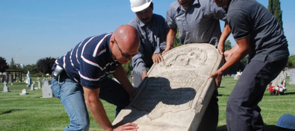
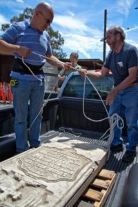
Pioneer of Santa Clara County would often end up at the San Jose Public Library, like I have, in the California Room, in the midst of librarian Ralph Pearce.  In August 2011, Ralph let a member know that he thought he heard someone had a Louis Pellier headstone laying around.  The group having found the younger Louis’s monument in their possession, the search for the Prune King was on.  History San Jose confirmed it in archive databases, but the collection was so massive, it was housed in many multiple warehouses.  They opened their doors to the Pioneers of Santa Clara and Ralph Pearce, together creating the “In Grave Danger Gang”.

The “In Grave Danger Gang” would commemorate the reuniting of the Pellier Monuments on November 2, 2011 with Lester family, Pellier Family and the Pioneer Society members.

IMG_4028 [2794442]So, when I popped up at Oak Hill and asked for Louis Pellier, I wasn’t expecting the helpful lady to call me back with this little curve ball.  A two year old curve ball too young to be either first or second generation Louis.  Who’s this little guy?

Ralph Pearce and the Santa Clara Pioneers Society helped me figure it out!  It was buried deep in census statistics from the 1870’s and figuring out who was in the household who was old enough to father this child.  This little guy Louis belongs to another Louis Pellier, son of Jean Pellier.  This is the fourth generation of Louis Pellier, here who passed as a boy.  Jean’s son Louis A. was born in France in 1852, moved to the States with his family and married Christina Frances Alvarez.  They would have a son and also name him Louis A.  Whoa.  Those family names.  You could certain understand the confusion was all had.  Which brings up a whole new question.  Where’s the other L. A. Pellier located now?


Have you hugged an Oak today?

Deer Valley - Joseph D. Grant County ParkP1310568When you think of “evergreen” and trees in general, chances are you would think of Christmas trees or redwoods.  Evergreen’s trees are not this connotation of evergreen.  In our dear Evergreen, this couldn’t be further from the truth.  In fact, our indigenous trees would inspire the name of the township, the communities surrounding it and many of its public schools today and not of them are coniferous.  The natural beauties of Evergreen would inspire poets and artists throughout its history.  These trees too are evergreen but the kind we generally think of.

P1310885image001Misnomer: Evergreen School District’s old logo may be Evergreen trees, but that might have come from the commemorative redwoods planted for the Evergreen School’s first teachers, like Markham and KR Smith.  Evergreen was named for its lush, green hills covered in oak trees.  I think if the name Oakland wasn’t taken in California, Evergreen might have been called Oakland.  It’s all rich oaky grasslands with natural creeks which made hills green year round before farming irrigation.

P13105995986045244_160c2c7376_oEvergreen definitely has some gigantic, wicked oak trees today in the oddest places amongst modern homes and along every creek, of which we have many.  There are different species of oak trees around Evergreen.  The oak grove along the Quimby Creek would give the name to Quimby Oak Middle School, built in 1968.  It was built before Millbrook Elementary, built in 1985, which was named after a mill along this brook some 150 years old.  Millbrook was built on the property owned by Henry Lambert Stephens, Evergreen pioneer since 1866.  In fact, There’s a haunting oak tree in front of the former mill owner’s house today.  Don’t worry.  I’ll get you a better photo.  This oak grove made way for houses and orchards.  Quimby Oak Middle School is more likely the Victoria Chaboya property, not Mayor J. A. Quimby’s.  He would’ve lived above Ruby Avenue.

CAM11117The Honorable Judge Jerry Kettmann would show me oak trees in Evergreen that were over 200 years old.  These would’ve been well grown in before the Judge would tend the Kettmann Family Ranch.  These oak trees served the purpose of landmarks, deciphering the locations along the Kettmann ranch in a developed neighborhood of Evergreen.  The neighborhood grew up around Kettmann Ranch in surrounding Cadwallader and Smith Subdivisions.  This was once a large farm, actually two adjoined farms, in Downtown Evergreen.  The town of Evergreen must have looked very different back then.  These space oaks would be unchanged relics of a time before ours.

Silver%20OakEvergreen MoonSilver Oak Elementary School, built in 1994, was named for a particular tree that was silver in color up on the hill above the school in the 1990’s.  The discoloration ended up being an illness this picturesque oak would come down with.  Silver Creek Country Club removed the tree because it wouldn’t continue to be safe with the moving of earth around it that home building required.  Never underestimate the beauty of a single, stand alone oak, though.  This is such a common theme in photography from our community.  The motif continues to inspire people today.

P1310608P1310620Holly Oak Elementary School would be named for the trees found along Dry Creek, renamed Thomspon Creek in 1974.  Hollies wouldn’t grow all over Evergreen.  There’s also a Coastal Live Oak species, which looks more similar to holly, that grows along that creek specifically.  I’ve enjoyed many a bike ride through this area and have gotten scratched.  There’s also a shrub species, Heteromeles, which is also knicknamed  California Holly that I certain recognize around Evergreen.  Maybe these two tag teamed the Thompson Creek creating a Holly Oak grove.  Or it’s something completely different.  Holly would also have another meaning like Hollywood.  Holly would mean magical.  Either these were magical oaks or these were holly-like oaks.  John Aborn would’ve pioneered this neighborhood and raised his daughter here, advocating for the rights of homesteaders and a defendant of Chaboyas.

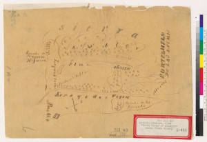
P1300673The varieties of oaks themselves are evergreen, so it’s only natural so the name is only natural.  Evergreen hosts a number of species.  “Blue Oak” Natural Reserve is tucked away beyond Joseph Grant Park to observe one of our species.  Valley Oak with distinctive leaves would prefer lower elevations of Evergreen.  Creeks and natural springs kept grass alive on the hillsides year round.  Chaboya’s cattle ranching business wouldn’t have changed a lot of Evergreen’s landscape.  With so many green trees, and rolling grasslands, the place begged the name.  The word “evergreen” simply meant green all year round.  In fact, Antonio Chaboya would mark Rancho Yerba Buena boundaries using cattle brand and the oak trees.

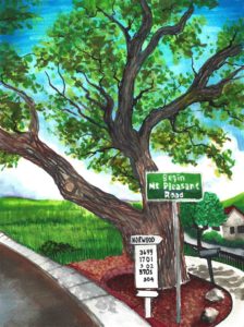
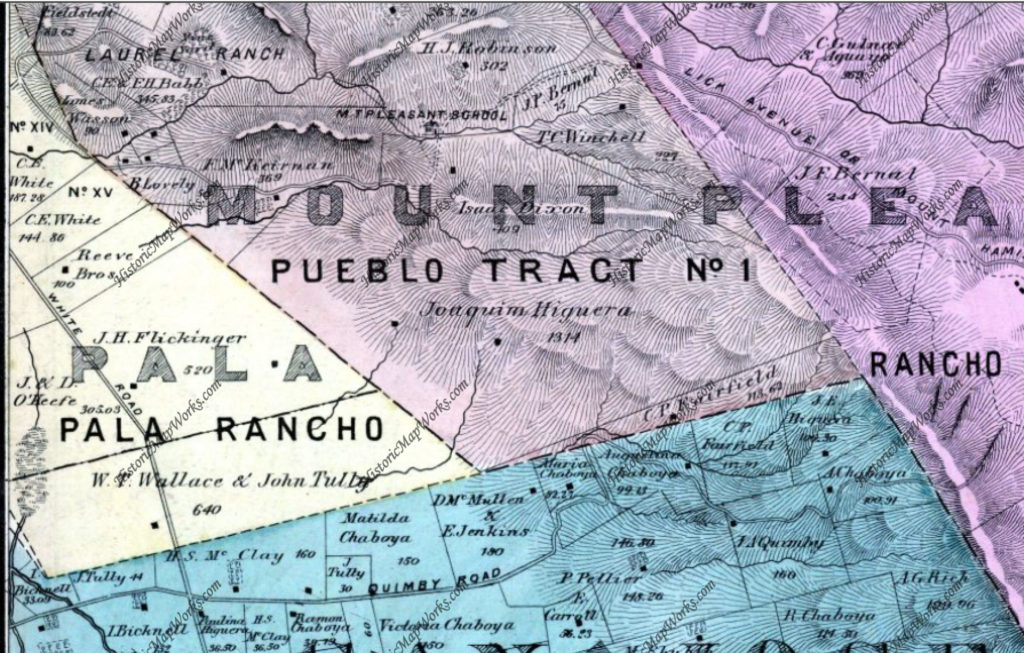
1421300_242476552761125_6880580855870102685_oMap 006, San Jose, Evergreen, Silver Creek, Mount Pleasant, PalThe Norwood neighborhood would get its name from Northern woods in the township of Evergreen.  The map to the left predates the avenue, however the avenue exists along this Green border.  It’s no coincidence.  The Norwood and Quimby Creeks would keep this area heavily wooded, and that element can still be felt there today.  This hillside would’ve been cleared for orchards or vineyards in the mid 1800’s.  I’ve gone on many drives to connect with Evergreen, one of them through this neighborhood, and our oak groves are a continued point of inspiration.

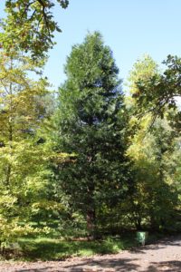
Calocedrus_decurrens_PAN_2hb896nb4gd-FID3Cedar Grove Elementary was named for a natural grove of cedar trees.  California Cedar, or Incense Cedar, could have been indigenous to Evergreen and this Northern wooded area.  That’s this one on the right.  This coniferous cedar grove would’ve been a part of this larger forest known as Norwood.  If it’s indigenous, it was a natural boundary for cattle herding and for the Ranch of Yerba Buena, you can see it on the Chaboya map.

Screen Shot 2015-10-27 at 4.01.24 PMCedars could’ve been planted along San Felipe Road to provide shade through this area when Spanish settlers founded Mission San Jose in 1797 and possible when Mission Santa Clara was founded in 1777.   You can see them on the San Felipe route in the old map here and ought to be this area with doubled up trees.  Cedar Grove may have been planted as early as 1821 by the Chaboya family to reinforce the border between Yerba Buena and neighboring ranchos or pueblo lands that eventually turned into East San Jose.  In the 1800’s, this would have been a popular source of lumber for building.  Norwood Avenue would be established between 1876 and 1899.

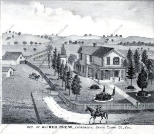
1876 MapJ.E. Brown, Theodore Lenzen Residence, Geo. H. Briggs, J.E. RucCedar Grove Elementary appears to be located in this John Tully property, once jointly owned in partnership with Wallace engaged in the lumber business in 1876 found at the top corner of this map.  It’s quite possible the Tully & Wallace company cut the grove down, build their homes and made way for orchards fed by the natural creek nearby.  These are cedars seen is Alfred Chew’s front yard.

118206-004-C50E9F7BHowever, looking at all the varieties of cedar trees to find the origin of Cedar Grove’s name, there’s cedar all around us in Evergreen.  I never realized how often it pops up now that I know the difference.  I think this is a cedar in my own front yard.  Seen here to the left, this cedar tree is a staple of Evergreen today.   Cedrela or Cigar Box Cedar species is all over the Evergreen Community today as a decorative tree, especially this neighborhood surrounding the school.  This species was native to Mexico, so it is not beyond the realm of imagination that these trees came with the Mexican or Spanish Empires.  They’re drought resistant so they’re widely used in landscaping today.

P131069617265953-Laurel-wreath-Decorative-element-at-engraving-style--Stock-VectorLaurelwood Elementary School would be named after a natural bed of Laurel trees. Coastal Bay Laurel, Umbellularia californica, would be prevalent in the Santa Cruz Mountains, but huge laurel groves would cover this area too thousands of years ago.  A climate change would shift that evolution and laurels would recede and make way for our oak groves.  This event took place all over the world in laurel forests in Mediterranean and subtropical climates.  Laurels are most notably the leafy thing behind the ears of many Greek and Roman statues.  I hadn’t realized laurel trees and the avocado were relative plants.  If a wood or forest of laurels existed in Evergreen in the 1800’s, it would certainly be notable.  Today, laurel shrubs and trees can be found on the school’s campus.  Some of these shrubs around Thompson Creek behind the school would appear to be flowering, blossoming laurel bushes.

197812780Beyond that, trees and varieties continue to inspire the naming of streets and neighborhoods.  “Glen” and “dale” all refer to clusters of trees.  That’s right.  Willow Glen was named for a cluster of Willow trees, also a township founded approximately the same time as Evergreen.  Evergreen was named for its out of world beauty and would draw tourists to its trees.  The Creeks created these groves, but would later empty into the orchards’ and farms’ irrigation systems.  Before that, Lake Cunningham, then Silver Lake, would flood into creek beds.  This would continue to be a problem for the Evergreen Township, but a win fall for the trees.  If you’re ever curious about the name “Evergreen”, just take a drive through the hills.  You’ll get lost in the natural wonder in your backyard.  To say our roots are Evergreen is an understatement.

Evergreen postcard graffiti evergreen

5985404833_eb2e904b36_bRecommended Routes for unspoiled beauty:

Silver Creek Valley Road, park at the shopping center and take a little walk.

San Felipe Road, make a right on Silver Creek Road, notice the awesome Silver Creek and its wicked silvery oaks

Follow Quimby Road until its windy, it quickly becomes stunning and natural

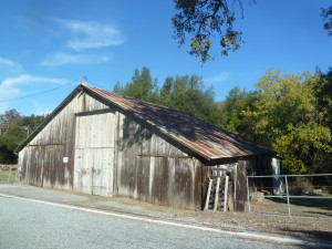
From Murrillo Avenue, make a right onto Chaboya Road, the Sikh Temple is beautiful but just beyond are rustic barns shaded by hundreds year old oaks

Follow Tully Road until its windy, it quickly becomes stunning and natural with excellent farms and oak land to see

P1300699


Grave Discoveries

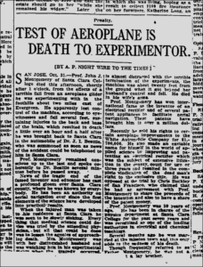
montgomery deathSo often all I have to go on as a portrait or physical evidence for my Evergreen historical figures are obituaries and/or gravestones.  The first person sources have moved away or passed away.  Strangely enough, you can tell a lot about people by their headstones.  Actually, you find out the legacy the person left behind by what their family are able to provide them for the afterlife.

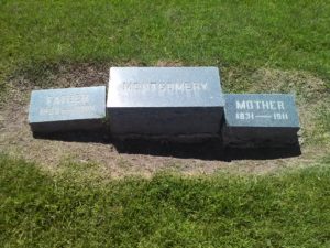
CEM47024782_124197784496San Jose, the oldest Californian secular development, also has the oldest “secular cemetery”.  Try saying that 5 times fast.  Oak Hill’s 32 acre burial ground would become the final resting place for many pioneers and historic figures in Santa Clara County’s infancy and adolescence.  I drove around and recognized a lot of street names like Curtner, Angew, Reed, Quimby and others.  Noticables like San Jose’s first Mayor, Joseph Belden, T. S. Montgomery and Donner Party were buried here.

If you’re creeped out by quiet, open spaces, cemeteries or death in general, all which I am, I totally suggest what I did.  I went to Oak Hill Cemetery on Father’s Day, when there were plenty of people around.  In fact, it’s a hot spot on certain holidays.  Don’t worry.  You’ll feel there might be enough living people to even out your creepy crawlies.  These days, the scent of flowers and incense can be detected amongst laughing, music and family.  It was quite a warm place.  I felt very free to wonder around.  You don’t need to wonder, however.  You have me being nosey on your behalf.  If you’d like to go on an unscary tour, I’ll be your tour guide.

First of all, cemeteries like neighborhoods and cities would be developed in a predictably chronological fashion.  This may not mean much when you first get there, though.  The area between the Curtner Avenue Entrance and Monterey Road Entrance to the North and those roads’ intersection would be planted first.  Certain families, tribes or ethnicities would cluster in certain lawns.  Roads would occur through the burial ground, separating these clusters and the earliest as well as most prominent characters would end up along the path.

CAM11106CAM11105Secondly, not all gravesites are created equal.  The wealthy would have larger headstones, build monuments or encapsulate their family plot.  There were beautiful headstones I might just photograph for their sculptural and artistic value.  You can take in a lot of information visually.  In fact, when cruising slowly through the paths, names clear enough to read from your car are simple richer or more famous people.

Whether is was ornate crosses, angels, obelisk, columns or awesome granite, these are their own communication.  They indicate faith, job, stature, origin and impact.  A cross would symbolize this person’s connection with their religion, and the style of cross might say they were Irish, Catholic or Episcopalian.  An angel might communicate that this person was very kind or had a direct positive effect on others.  A Corinthian column is someone who was stoic and politically minded.  You’ll have a bust of the individual if there are revered.  The subject matter says a lot about the person.

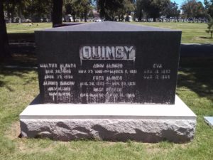
CAM11091San Jose’s early Mayor, John Alonzo Quimby is at Oak Hill.  Here spelt Quinby, the lawmaker was probably a Quaker and opted for a shared fairly unadorned headstone.  It is large and a beautiful block of granite stone.  J. A. Quimby is featured prominently in the middle of the arrangement, surrounded by his loved ones.  The Quimby’s was probably a close knit family, as well as one with modesty.  This was towards the front of the 32 acres of cemetery.  Mayor Quimby was a very well respected man at the time and given the visibility belonging to important folks.

120013655_138395571327129607541_1399786781Let’s contrast that with our wealthy French family, the Pelliers.  Not all of them would end up in Oak Hill Cemetery.  Louis, both the brother of Perrier and his son, would end up at the Catholic Cavalry Cemetery, where the rest of the whose who and pioneers would end up.  These resting places are very orante or fancy, just like the French.

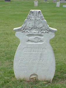
120929472_1115576029207The Germans would also have their own style.  Hands shaking was a popular motif.  The Prusch Family of Evergreen and it’s surrounding area would have something that communicates their German roots.  I think it’s very similar to tapestry from the Dark Ages.

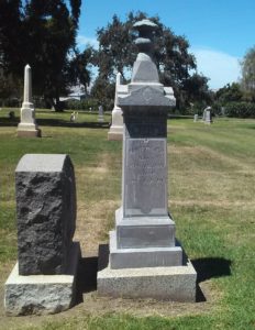
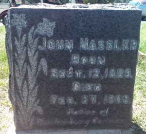
CAM11108The German immigrant and wealthy farmer from Evergreen, John Hassler, would use the symbol of the lily on his gravestone, indicating a fondness for the Bible, or Word of God.  His headstone is minimalistic yet bold.  This would indicate a value placed on the simple life.  That makes sense.  Beyond fortuitous land dealings in Evergreen, John Hassler was a simple farmer and his family continued that tradition.  The Hassler’s Patriach wouldn’t need any help holding down this beautiful granite stone.  But don’t worry.  Plenty of his loved ones surround him with simpler plots.

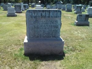
CAM11098spring2012.pdfMr. and Mrs. Metzger, also German, ended up together in the end, even though fifty years would separate their passing.  The farmer’s headstone if a block of granite with a nouveau classical element, clearly foliage.  It’s similar to the family’s home and it’s most likely Mrs. Metzger’s taste guiding the decisions here.  What separates this gravestone from the above Hassler’s is a couple years and new technologies for cutting.  This means the styles have changed and the gravestones do the same this.  This comes from San Jose’s Victorian period.  The stone says a lot.

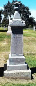
CAM11105 (2)People who had been in the United States for some time, like Alfred Chew, would opt for something very American as a memorial.  Native of Ohio, civil servant Chew’s headstone would tell us he was a stable man, because of its height and shape.  The triangular front mimics the architecture of government buildings.  All it’s missing is columns, but it itself is a column which speaks to his stability and legacy.  We can also see that Alfred Chew was a farmer with flowering accents.

Now, Evergreen’s neighbors wouldn’t end up anywhere near each other.  Certain neighbors would be close by or located in the same lawn, but I believe that has more to do with the timing of their death.  It was not the closeness I thought there would be based on pockets of German or French immigrants in Evergreen or everyone’s reports of a close knit community.  The experience was tremendous, however.  The next time I visit, I’m going to bring a list of names of people supposedly buried here and get a little help from the desk.  I’m going to make a list and a map so you don’t have to wonder around aimlessly.  For me these headstone told me so much about how these folks were remembered and the time they grew up in.


Evergreen’s Own Mayor Quimby

mayor quimbyWould you believe me if I told you that Evergreen and the City of San Jose had a Mayor Quimby over 125 years before the Simpsons?  Matt Groening’s portrait of the Mayor couldn’t contrast our factual character more.  I’m going to try to provide you with an accurate portrait of our fair-minded Mayor, John Alonzo Quimby.  I was lucky enough to find a contemporary family source in a Genealogical History for the Quimby Family from 1915, though newspapers and political publications didn’t say much..

quimby-coat-of-armsQuimby as a name is fairly popular in England, where its origins are traced back to the 11th century.  Though probably Germanic in origin and possibly Hebrew in its roots, the Quimby name, its variations (Quinby, Quinbee, Quenby, possibly Quincy, etc.) and its coat of arms are found all over England.  It dates back to an ancient Welsh King,  The Quimby Family came from a long line of Colonialists and Quakers.  The ancient family would come to Salem, then Massachussetts colony as early as 1640, seeking freedom from the religious persecution that brought so many people to America at the time.  They were not rumored in Salem Witch Hunts, but one relative died in heated fights with the Native Americans there.  His ancestors would’ve fought to create this country.
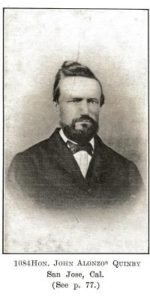
thumb200John A. Quimby would be born in Parsippany, New Jersey in 1818 to affluent, well respected parents.  His father would be a politician in New England.  Quimby’s father originally ran the lucrative family shoe making business before running for judge and serving the County court system 25-30 years in New Jersey.  His brother, Isaac, would be a General for the Union Army during the Civil War.  This is his famous brother from Back East to the right who eventually became a US Marshall.  My historian’s note here would be that photographs through the 1800’s would only be taken by the rich and famous or very large groups.  It was an infant of an art and a science as well as expensive to do.  Strangely enough, the politically minded family were Democrats for the most part, with the exception of our Mayor.  This may be the reason the Republican pioneer came to California in 1846.  Regardless, this photograph from the mid 1800’s should prove how well respected John Alonzo Quimby was.

Mayor Quimby first studied law and practiced with a Judge in New Jersey.  John Alonzo Quimby would come to California as early as 1846 with his father, but definitely arrived in Santa Clara County by 1849 with his first wife, Minerva Moody of New York.  It was said before leaving New Jersey that J. A. Quimby was one of Morristown, New Jersey’s best orators and they had a few.
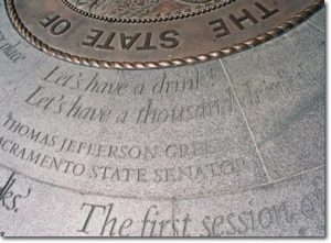
drinksJohn Alonzo Quimby would become entangled with California’s State Affairs early on, even running for US Senator at one point.  Quimby was present, along with delegate Charles White, at the “Legislature of A Thousand Drinks”, held in San Jose in 1849.  This Assembly would create California’s State Constitution and the creation of its Capitol, in San Jose.  In 1850, Quimby would see the need and build the first roadway from Santa Cruz to San Jose, laying the groundwork for Highway 17 today.  John would engage in the lumber business there as a City developed in the Valley.  The Captiol would move to Vallejo in 1851, and to Sacramento.  Even still, the site of the Capitol would become a second epicenter for the City of San Jose.  Quimby would be in the California legislature from 1855 to 1858 and be San Jose’s Mayor for two terms from 1863-1869.  J. A. Quimby would later be on the Board of County Supervisors for two terms.
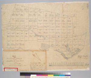
hb8r29p1tf-FID4scuThe well-respected lawmaker would become the creator of the Downtown San Jose we know nowadays.  For the sake of contract, the map to the right is San Jose in 1847.  It has a single road, the El Camino Real, today’s Alameda turning into Santa Clara beyond this point.  It’s layout is logical, like the numbered street we know, and it has well known San Jose founders sprinkled in.  The Guadalupe River creates a border for the small city.  At this point a lot of today’s Downtown isn’t even a thought.   In 1847, an acre of land downtown like these would cost $50.00.  Through his initiatives, crucial issues that arose in San Jose at California’s birth were solved through Mayor Quimby’s terms in office.
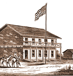
san_jose_2The Market Square was always a meeting place for the Pueblo of San Jose and so it only seemed fitting to hold California’s first meeting in California’s first civic meeting place.  In 1797, the Spanish would raise a Town Hall at the site for parades and City meetings.  There would be reports of ill maintained hotels and flooding at Market Square, which encouraged the Capitol’s relocation to Vallejo.  A dam would need to be built for the Guadalupe River to keep the Capitol dry.  This building still used in 1851 for San Jose’s administration, John A. Quimby would inherit San Jose with its run down buildings and infrastructure.  The Fire Department had no firehouse and broken down engines.  City Hall’s walls were crumbing.  After all, it was over 65 years old by the time he got to City Hall.  Furthermore, in 1863, the disputes created by settlement were still creating tensions.
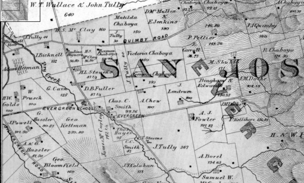
1876 MapRancho Yerba Buena wasn’t up for dispute anymore.  John Alonzo Quimby himself legally purchased a large ranch 3 miles from Downtown Evergreen, next door to the Pellier Family, near where the Middle School stands today but up the road a little ways.  Victoria Chaboya’s property is more likely where the Quimby Oak Middle School stands today.  Oak trees are a main feature of Evergreen, not pine trees.  Quimby Oak rather rathers to the bed of Oak trees gathering along the Quimby Creek, running though Quimby and Pellier’s properties.  Quimby Road would always run past his Evergreen hills property.  J. A. Quimby was able to purchase a Creekside property near where the Chaboyas themselves called home.  The California Government didn’t uphold all of the Mexican land grants like the Chaboyas.  In fact, Rancho Yerba Buena was the exception to the rule in Santa Clara County.
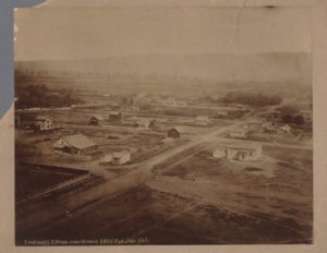
83f041e62c3569668922074fec6eb474Many were stripped of their holdings and left tiny portions of their former farms, including Antonio Chaboya’s brothers, by US Surveyors.  The railroad into San Jose was completed in 1863, when Quimby first became Mayor.  The land grab created room for new immigrants and U.S. citizens in early San Jose, which there were plenty arriving and on their way.  The first secular development in California, established in 1777, had been growing from the epicenter of Mission de Santa Clara de Asis, today’s Santa Clara University.  These homes, though close, were large and had adequate yards.  If these people were also farmers, though, their farms or vacation homes would be elsewhere, in modern day suburban communities surrounding San Jose’s Downtown.  To the right is Downtown San Jose looking towards the Mission in 1866, when J. A. Quimby was Mayor.
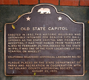
old_state_capitol_plaque_thumbMission Santa Clara feels like the outskirts of Downtown today.  You’re totally right.  What we feel like is Downtown today, First and Santa Clara Streets, would be John Alonzo Quimby’s impact on San Jose.    The one time Capitol, brought by delegates White and Reed and witnessed by Quimby no doubt, would be today’s Cesar Chavez Square on Market Street.  This would become a second burst of growth in San Jose’s adolescence.  Downtown is something different because of this second epicenter.  The bustling City would then center around Market and Santa Clara Streets, adding to the numbered streets and narrowing their lots.
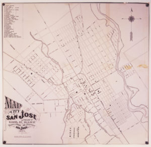
SVHO2004-0812Then, during his Mayoral office, Quimby would bring together both parties to handle the disputes, fill San Jose’s Treasury by selling small “pueblo” lots Downtown and create services for the growing population.  Contemporaries would explain that the Cities of San Jose and Santa Clara were already touching and growing denser down the Alameda.  Plots were being sold for $50.00 an acre or city block around the Alameda and St. James Park.  Once Quimby took office, an acre cost $200.00.  US Surveyors would bring into question some of the $50.00 acres, allowing farms downtown to be broken up into subdivisions.  $50.00 plots were still being developed, however.  The City of San Jose would be considered as far east as Coyote Creek, as far south as Bird Avenue, as far west as Meridian Avenue and as far north as Hedding Street.  Quimby would improve the roadway system and rejuvenate San Jose’s infrastructure with the raising of funds, replacing rundown equipment and buildings.  Many of San Jose’s oldest standing buildings come from the Quimby era.  With a focus shifted away from the Mission and towards developing outward from the City Plaza, Cesar Chavez Park, Downtown San Jose’s small lots still exist today.  The numbered streets are a result of many of Quimby’s decisions.  He killed two very big birds with one very awesome stone that still can be felt today.  To the left is a map of San Jose shortly after he left City Hall.
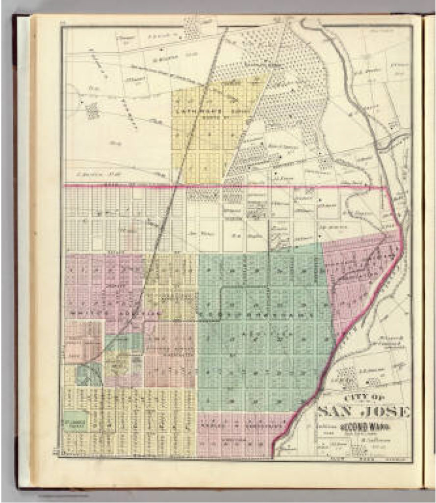
San Jose 2nd ward. - David Rumsey Historical Map CollectioncaThis is a map of San Jose while John Alonzo Quimby was on the Board of County Supervisors.  The rapid growth was prolific.  In 4 years, San Jose would need to be broken up into huge portions.  This is our modern downtown.  The First Ward is the old downtown.  Also notice that our Norths between the previous 2 maps are different.  That was just to make this one look pretty.  It’s ok.  Our 1847 Map had Guadalupe through then San Jose’s west on the bottom of the map.  Only a couple of those original rectangle bought for $50.00 still existed.  Most were these tiny boxes in 1876.  The colored portiosn are additions onto San Jose made during Quimby’s term.
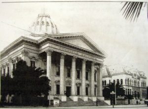
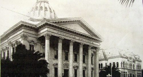
Courthouse1895Courthouse2007In 1860, San Jose would have 1000 residents.  By 1868, that had been multiplied to 7000 residents.  Having great leadership at the helm of a storm like that allows the transition to go smoothly.  John A. Quimby found a way to make room, make jobs, and revive an aging city.  He was also there at igniting of the Santa Clara County’s Fruit Industry.  Quimby would create the foundation for the large city with a dense downtown we enjoy today.   The San Jose Water Company was incorporated in 1866.  Gas services was introduced to San Jose in 1861, but the need for expanding those pipe systems were crucial.  The Normal School, today’s San Jose State University, would become State run in 1862.  The courthouse was built in 1867, now the St. James Post Office though its down was burned down some time ago.  The first public transit systems were in place in 1868, running down First Street to the domed courthouse.  The lightrail stops there today.  Does that make is a nearly 150 year old tradition to ride the modern trolley through Downtown?  The Canning Industry would be underway in San Jose in 1871.  Though Quimby gets the bulk of credit for the way he settled Downtown land disputes, he’s often overlooked during this crucial time in San Jose’s development.  Why he’s overlooked in unknown, because he seems to be well-respected by his contemporaries and loved ones.
CAM11091John and Minerva would have four kids, while maintaining his political life.  Minerva Moody would pass away in 1866, while he was Mayor, and John Alonzo Quimby would remarry the following year.  Irene Kamp, the new Mrs. Quimby, and John would have another two children who were also raised in Evergreen.  After serving the County for a number of years, John Quimby would become sick for a number of years starting in 1886.  Following the illness, Quimby retired from public life to his Evergreen farm.  It was said that he too raised vineyards in the Evergreen hills and Quimby Creek runs along the back side of Millbrook Elementary School today.  Quimby Road would be one of the third or fourth roads built in Evergreen, after San Felipe Road and Evergreen Road.  In fact, Quimby once ran Tully Road’s modern course into town after the turn at Eastridge Mall.  The Mall’s creation there was formed by Quimby’s 150 year old route.
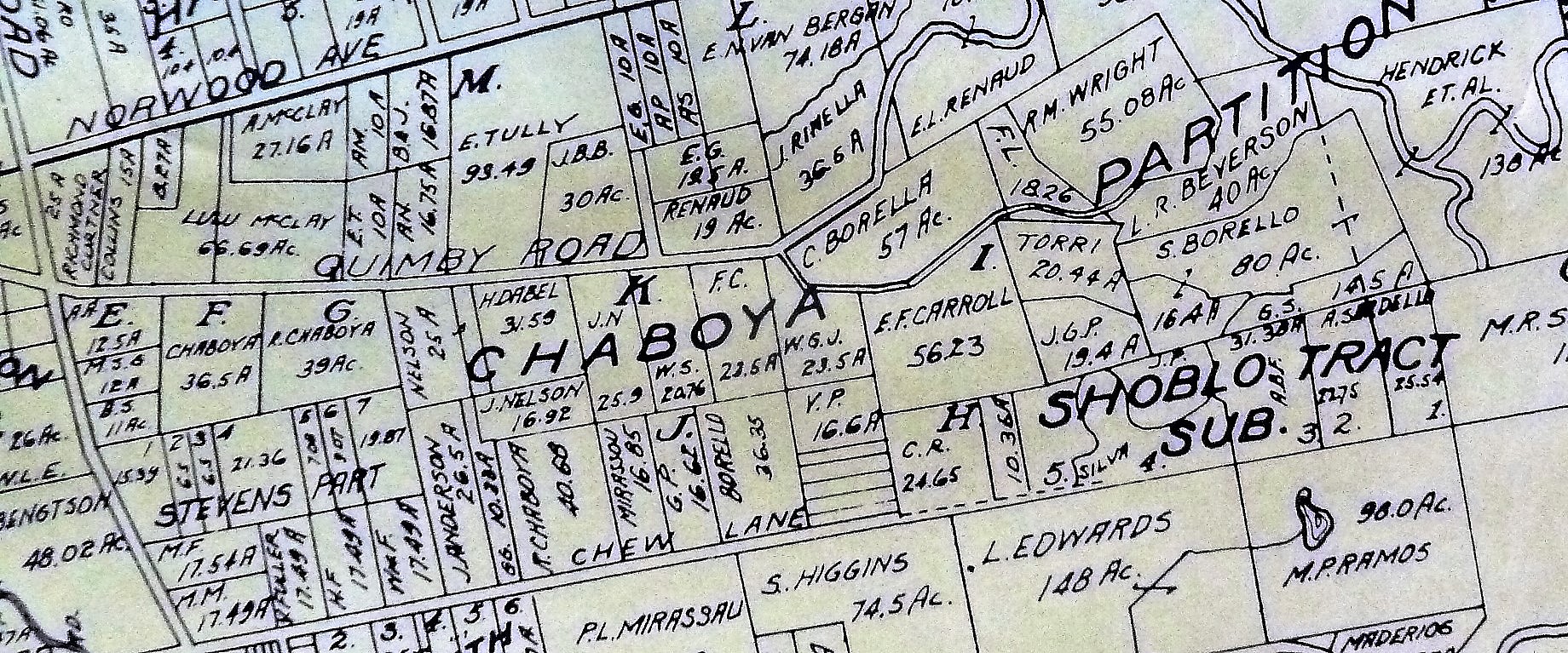
P1310216 (2)The large Evergreen estate passed to Irene and his family when John Alonzo Quimby passed in 1891.  This 1903 map shows a portion of the Quimby Ranch, 55 acres, still held by his daughter, Mrs. R. M. Wright.  One of his sons, Fred Alonzo Quimby, carried on the tradition of civic service into the 20th century, though sadly not in Santa Clara County.
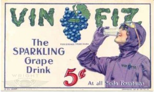
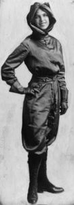
vinfiz_harriet58643d6960f486d90ad75b3a2f41f657Oh, and the awesome Harriet Quimby, first woman to have a pilot’s license, wouldn’t be from Evergreen or San Jose.  Instead, she probably heard about the road’s name on a flight to San Jose then lie ruthlessly about it, creating fairytales and misinformation about her early life.  Harriet was born in Michigan.  She was quite a character, but none of John Alonzo’s sons would marry a woman having a daughter Harriet.  She also freely lied about her age.  Don’t worry.  The Quimby’s are a huge family.  She probably wasn’t lying about the name, but could so easily weave misinformation into interviews because of the name’s popularity around the United States.

I think the obituaries for John A. Quimby about the most eloquent summarizations and indications of how he was received by his contemporaries, Democrat or Republican.  His was admired for both his political achievements and undertakings, as well as for his kindness and hospitality.

“Death of a Pioneer of San Jose – A Public Spirited Citizen – One who has served faithfully in various Public Offices and did much as a Private Citizen” said one local newspaper.  Another states “His life here since pioneer days was an active one until a few years ago… made him prominent amount residents of the county.”  It goes on, “The pioneer residents of this county will bear willing testimony to the deep regard entertained for the departed [Quimby] by all who had the pleasure and profit of an intimate acquaintance…”
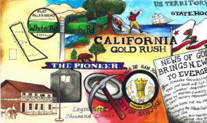
1833The Artwork which features J. A. Quimby also features possible inspiration Charles White.  After writing this, I’m wondering if we’ve given John Alonzo enough credit either.  His leadership created the City we enjoy today, which modern people from Evergreen continue to develop it and serve the same offices.  The Simpson’s bumbling Mayor couldn’t be further away from our Mayor Quimby.

After doing this article, here’s the updated White and Quimby Piece.
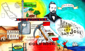
1833


Haunted Evergreen

When asking friends what they want to know about Evergreen, they wanted to know about old haunted places around town.  When I started looking, I found lots of haunting in Evergreen.  Whether it had been a tragic event on a campus or a scary old house, Evergreen has plenty of scary stories to accompany its beautiful tales.  Here’s what I found out and investigated myself.

Mandatory Credit: Photo by Jon Santa Cruz / Rex Features (582062k) Ouija board with pointer VARIOUS - 2006

First of all, I should say I have a fair amount of physical, experiential research on this topic.  When we were kids, and my older brother’s friend got the first license in the bunch, we did this.  I found kids still doing this and chronicling it on youtube.  Ghost hunting in Evergreen is a teenage rite of passage that is alive and well.  Let’s talk about some of the ghostbusting.

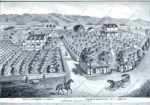
P1310652San Felipe Road appears to have the concentration of spirits in Evergreen.  I’ll explain what the sensation is and then why.  I would do my own paranormal investigation, with buddies, in high school 1999-2003 when we didn’t care who’s house it was and we didn’t know why we felt strange things in certain places.  The first time, we ended up at the Smith’s residences thinking it was the school house.  Back then, too, many of the new homes weren’t there yet and this stretch of road was fairly heavily wooded along Thompson Creek.  The Smith family homes are still privated by orange groves today.  It once looked like this with San Felipe Road running through these front yards today.

Charles C. Smith, F.J. Smith Store and Residence, Adam Herman,

P1310650That connection is Katherine Smith and the school house is across the street from her house.  These Victorian houses are occupied today, so don’t sneak up at night, okay?  What everyone thought was the haunted schoolhouse back in the day was not.  It’s the right spot, but across the street, renovated some time ago and totally not haunted.  The two story schoolhouse still stands, and is also inhibited.  The old one story school was torn down in the 1890’s.  Reports from San Felipe Road long time residents would also confirm the absences of a haunted schoolhouse, and the lack of any known massacres, murders or suicides that result in spirits.  We, Evergreenians, do, however, have an unusual number of haunted school rumors, just none on San Felipe Road.  Unfortunately, I won’t be disclosing them here either, because students still attend school there today.

5986045244_160c2c7376_oThe looking haunted house on White Road and Stevens Lane isn’t haunted.  I would be too chicken to Treat or Treat here as a child, though I can see its jagged oak tree from my own backyard.  I’ve come to find that it is owned by the nicest, long time Evergreen family.  Again, don’t sneak up on these guys – there are no paranormal activities here.  The family purchased it generations ago directly from H. L. Stephens, its original owner, orchardist and flour mill operator.  The mill would be near Millbrook School today on Quimby Creek.  Again, not haunted.  Very original in its construction and preservation, very discrete owners, spooky oak tree and daunting gate.  What you don’t get to see if the stunning wisteria and wrap around porch.  The only spirits here are warm and friendly.

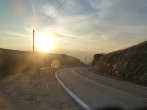
P1300592Headed south on San Felipe,  beyond Farnsworth, the road gets scary and dark.   It’s a beautiful daytime bike ride, not for novice riders, but a nighttime fright.  You will see old, rundown barns appear out of black oak trees and abyss.  This can seems scary.  Your cell reception will drop at the top of the hill.  Don’t worry.  Evergreen’s reception in general is spotty, but especially toward Metcalf Road.  You can either turn around or  go straight until you hit Highway 101 or Monterey Road.  The only need to worry is if your car breaks down.  There are too many reports of phantom cars and haunting along the roadway itself, so maybe we should spend a moment on that.

Historian’s note: Keep in mind that the invention of the printing press and its rapid improvement through the 1800’s means tragedies and crime would be recorded in newspapers at the very least.  These have not been streaming in from Evergreen or San Felipe Road or San Jose.  I’ve looked everywhere I can thing of.  I’m obsessed, too.  I can track every local news article, person, property development, purchase, division, dispute, etc.  Evergreen was downright peaceful after land disputes.

Screen Shot 2015-10-27 at 4.01.24 PMThough no haunted schoolhouse exists there, San Felipe Road may in fact be haunted.  Plenty of car accidents occur here every year, whether ordinary or foolhardy.  The haunting I like to speculate about is much older.  San Felipe Road itself can be dated back 200 years.

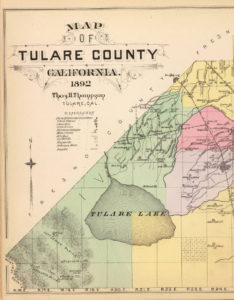
Microsoft EdgeDon Pedro Chaboya, Antonio Chaboya’s brother, would drive a band of cattle ranchers from Santa Clara and Monterey Ranchos after Native American horse bandits and most likely took the trip over San Felipe Road, furthest East and most central to the gang of ranchers.  The thieves would steal 600 head of horses, slaughter some of the animals senselessly and take flight towards Merced County.  The Bay Area ranchers would finally catch up with the bandits in Tehachapi, so probably not Ohlone Natives.  Laguna Tachi, where the capture occurred, here shown to the left, is on the border of Tulare County, Southern California.  The ranchers would return home with their horses and captured thieves.  I speculate this southeastern route is haunted because of the horses and natives who lost their lives in this event.  As a result, phantom cars can be felt.  Not phantom cars – phantom horses.  People also report hands appearing on the windshield while driving down San Felipe Road.  That’s probably our Native Americans being brought back for their punishment.

P1300635Or there’s a totally logical explanation.  Something like the coastal winds combining with low pressure systems to the South driving a wind Northward.  If you catch a gust of wind, could feel like phantom cars or horses.  If you can’t see the trees also fluctuating with the headwind, you’d be psychologically misguided and therefore spooked.  Your hands I can’t explain away.  This may be strong contrasts in heat in very specific places on your windshield from such a strong, cold headwind so sporadic in occurrence.

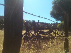
CAM10931Also on San Felipe Road but further towards Metcalf Road, you can get another scare.  If you didn’t know these awesome rusted pieces of antique farming equipment was out here, you might be frightened by their sight and traveling shadows.  With the lights on, or rather in the daytime, this old pieces of equipment are brilliant relics and roadway decorations.  At night, this looks like a creepy crawly nightmare.  Now, it your car won’t start for some reason on San Felipe Road, then you’re in trouble.

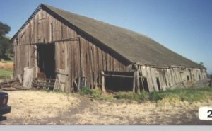
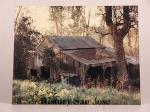
5985404833_eb2e904b36_b 6287362602_ddc1498c1c_o When I was a kid, there were so many more barns and abandoned structures.  I say kid.  About 15-20 years ago.  I’ve been on this ride several times throughout the research of this project. Things I intimately remember creeping into at night and being spooked by are gone.  They’re not there.  These structures have been documented, torn down and made room for more homes.  I find them again in archives and records.

spring2012.pdfSomewhere we would enjoy screams before it was enveloped by home development is a place others also report as having been haunted.  I can’t find much of this online, but the experiential data yielded positive results.  I know I was spooked enough  once or twice to bolt out of there.  Today, it’s a historical landmark that needs some love.  Reminds me of the Wehner Mansion, also with historic designation but no preservation.  (There were no reports of spirits from Wehner Mansion except wine.)  This is how I remembered the relic.

2012234

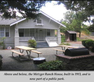
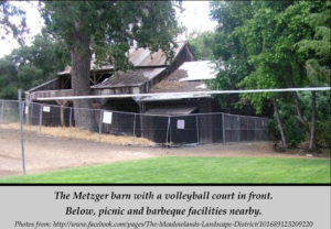
spring2012.pdfToday, the Metzger Barn still gets haunting reports but serves a dual purpose as a quasi-park.  Though secreted away, it’s open to the public.  The complex even has picnic tables and a volleyball court.  At night, there are reports of phantom rattling chains and ghostly crying observed.  I’ve also read about an experience with hanging animals from the rafters.  I’ve personally observed the heeby geebies.  I’ll not spoil this haunted tale for you.  Since I’ve ruined other perfectly good ghost stories, I won’t ruin anymore for you.

Joseph Grant Residenceuntitled2121Joseph D. Grant Park, very nearby Evergreen in neighboring Ranch Canada de la Pala, has a historical complex of structures and gives tours of the haunted main house.  If you want a frightful experience, you’ll have to sweet talk rangers or historians into coming back to work on their time off but it’s been done before.  Built in 1882, ghosts can be witnessed in mirrors, along with loud noises and footsteps were observed.   Other strange paranormal feelings would be reported by guests and park rangers alike.  Ghost hunters have enough evidence to confirm their own superstitions.

Evergreen has haunts you can see and some you can pass up on.  Metzger Farm and Joseph Grant Park seem to be your best bet for spirits.  A night drive over San Felipe Road and a misadventure up Las Animas Road are certainly spooky if that’s your thing.


The Man with a Hoe

Charles Edward Anson P1310885Markham (1852-1940) is characterized as a minor American poet.  Since he has Evergreen roots, we’ll designate him a major Evergreen poet.  Edwin Markham was a teacher at the Evergreen Schoolhouse from 1869-1889.  During those twenty years, he would write from the East Foothills and inspire and educate students from the Chaboya family, Kettmann family, Smith Family, certainly one day principal and superintendent, Katie R. Smith, Aborn Family , Chew Family and others.  He was so cherished by the community, a redwood tree would be planted in his honor.
markhamThough not published until 1899, ten years after Edwin Markham left the employment of the Evergreen School, I like to speculate about his inspirations.  The Oregon native wrote poetry about the working class life in the late 1800’s.  He would’ve worked on the family farm as a child, like most children at the time, in the north bay area.  He would finish his teaching credential at San Jose State, then known as the Normal School, and fall in love with Evergreen.  From 1921-1931, Edwin Markham would be Poet Laureate of Oregon.
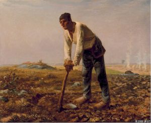
manhoe1Edwin Markham incites emotion through his metaphors and that familiar sense of earning.  It is often said that Markham’s “The Man with the Hoe” was inspired by Jean-Francios Millet’s painting of the same subject, shown here to the left.  That may have been a contemporary pop culture influence, however, Markham would get to see this activity quite regularly during his twenty year teaching stint in the town of Evergreen.
P1320557I have specific details about the farm adjacent to the schoolhouse using hoes, pitchforks and sickles, archaic equipment the immigrant family would’ve used in the old country.  The farmers in Evergreen during this time would have front row seats to the Industrial Revolution and watch their equipment mechanize before their own eyes.  Poorer farmers would have to work by hand until Evergreen’s labor force combined and circulated large rigs to harvest everyone’s fields.
Markham’s poetry would very much parallel the hardworking farmer’s plight during this time in history.  Evergreen was farm country, first appearing in the Altas in 1867.  Markham would move into Evergreen in 1869, as one time squatters became legal land owners and brand new farms were being raised all over town.  It would be harder to imagine Markham’s work not being inspired by his time in the little farming town 8 miles outside the City.
Here’s Markham’s poem.  If you enjoy this, read on.  His poetry is quite lovely.

The Man with the Hoe

Bowed by the weight of centuries he leans 
Upon his hoe and gazes on the ground, 
The emptiness of ages in his face, 
And on his back the burden of the world. 
Who made him dead to rapture and despair, 
A thing that grieves not and that never hopes. 
Stolid and stunned, a brother to the ox? 
Who loosened and let down this brutal jaw? 
Whose was the hand that slanted back this brow? 
Whose breath blew out the light within this brain? 
Is this the Thing the Lord God made and gave 
To have dominion over sea and land; 
To trace the stars and search the heavens for power; 
To feel the passion of Eternity? 
Is this the Dream He dreamed who shaped the suns 
And marked their ways upon the ancient deep? 
Down all the stretch of Hell to its last gulf 
There is no shape more terrible than this — 
More tongued with censure of the world’s blind greed — 
More filled with signs and portents for the soul — 
More fraught with menace to the universe. 
What gulfs between him and the seraphim! 
Slave of the wheel of labor, what to him 
Are Plato and the swing of Pleiades? 
What the long reaches of the peaks of song, 
The rift of dawn, the reddening of the rose? 
Through this dread shape the suffering ages look; 
Time’s tragedy is in the aching stoop; 
Through this dread shape humanity betrayed, 
Plundered, profaned, and disinherited, 
Cries protest to the Powers that made the world. 
A protest that is also a prophecy. 
O masters, lords and rulers in all lands, 
Is this the handiwork you give to God, 
This monstrous thing distorted and soul-quenched? 
How will you ever straighten up this shape; 
Touch it again with immortality; 
Give back the upward looking and the light; 
Rebuild in it the music and the dream, 
Make right the immemorial infamies, 
Perfidious wrongs, immedicable woes? 
O masters, lords and rulers in all lands 
How will the Future reckon with this Man? 
How answer his brute question in that hour 
When whirlwinds of rebellion shake all shores? 
How will it be with kingdoms and with kings — 
With those who shaped him to the thing he is — 
When this dumb Terror shall rise to judge the world. 
After the silence of the centuries?

Alfred Chew’s Residence

J.E. Brown, Theodore Lenzen Residence, Geo. H. Briggs, J.E. Ruc000000The people and places featured in books and publications back in the 1800’s were highly regarded as well as some of the only glimpses into other places at the time.  Alfred Chew was made popular by the Thompson and West Altas published in 1876.  Print was a limited medium, but made the exchange of information possible.  Tales of the Western Frontier being tamed were becoming public knowledge as fruit, dried and canned, would reach the East Coast from Santa Clara Valley.  The building of railroads brought many people to California through and after the Gold Rush, but also made the export of fruit and curiosity a real commodity.

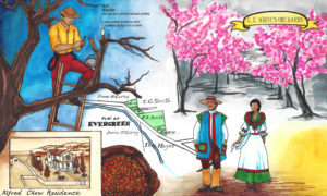
mapImages of Santa Clara Valley were published for the whole world to delight in, along with our bountiful produce in the Valley of Heart’s Delight.  This would’ve also served as a tourism guide of landmarks to see when visiting the area.   Evergreen and Silver Creek were located in the Rancho Yerba Buena Survey, eventually becoming the whole of Evergreen.  The associated map for the above photo is to the right, from Thompson and West’s 1876 Atlas with Alfred Chew’s residence featured.  Fitting, the Survey of mention is in green.

P1310192As you can see from this 1890 map to the left, before the turn of the century, Aborn Road was known as Evergreen Road west of White Road and San Felipe Road.  To the East of San Felipe Road, the heavily driven Evergreen artery Aborn Road was known as Chew Lane.   The Chew property is also featured here in the 1890 map at the top right corner along Chew Lane.  That got me chewing on who Alfred Chew was.

caMr. Alfred Chew (1834-1910) would do a little traveling from his Ohio home front before settling down.  Young Alfred would come with his parents, Morris Rees Chew and Mathilda Crumley, to live in Illinois before traveling West on his own.  In 1853, Alfred Chew would start his journey West with the Kirkpatrick Company, headed for Oregon and making the most out of getting lost at the Missouri River.  Kirkpatrick didn’t immediately arrive in Oregon that time.  Before becoming a farmer in Evergreen, Alfred would meander South into California.  We know about Mr. Alfred Chew for his leadership in early California Statehood in different areas of the State.  Alfred Chew would run cattle through Gilroy before he would suffer from typhoid fever.  Before returning home to Illinois in 1860, Mr. Alfred Chew would pursue government posts, and surely a different type of occupation than he had before.  He was the US Deputy Surveyor for San Luis Obispo County in the late 1850’s.  Alfred Chew would return to Illinois and marry Margaret Kennedy, returning to Evergreen with his new bride.

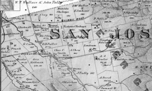
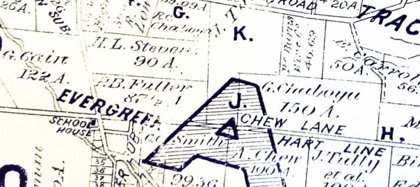
0000001876 MapAlfred Chew would come to Evergreen and begin farming in 1860 3 miles outside of Evergreen.  Alfred Chew would take his year’s profits and purchase a portion of attorney William Matthew’s property near downtown Evergreen in 1861, which was granted to him in exchange for legal services from the Chaboya vs. Squatters battle in years prior.  This 1896 map shows no road where Chew Lane and now Aborn Road exists.  Evergreen literally grew up with and around the Chew Family homestead.  This is a black and white close up of the 1876 Thompson and West Altas with Chew’s property under “SAN”, before the road in his name was created.  He would’ve moved in right next door to Charles Smith and Genrio Chaboya as one of the first residents of Evergreen.

ls1After his winfall year farming 200 acres 3 miles outside of Evergreen in 1859, Chew would buy 100 acres of his own and build his home in downtown Evergreen.  He would raise 7 children with wife Margaret, Mamie.  They would’ve gone to the Evergreen Schoolhouse.  Mr. Alfred Chew would return to civil service, elected to the Board of County Supervisors in 1873.  He would serve on the Board from 1874-1878.  Chew would also serve in Santa Clara County’s Assessor’s Office into the early 1900’s.  Both his wife, Mamie, and his daughter, Emily Ann or Emma, would teach at the Evergreen Schoolhouse down the street from his downtown Evergreen house.  Emma would also marry into the well-known, well liked Hostetter Family, who found their way to Santa Clara County with the Evergreen Farnsworth family guardians.  Over the 50 years Alfred lived in Evergreen, Chew’s neighbors would sell their large downtown Evergreen farms away to make room for subdivision housing.  Evergreen would continue to grow in population.  Chew’s farm had a very different fate.

Mr. Alfred Chew’s Obituary would read “PROMINENT SAN JOSE ORCHARDIST IS DEAD Alfred Chew,” County Treasury Watchdog Passes Away SAN JOSE, Calif.  Jan. 2. — Alfred Chew, for 33 years the “watchdog of the county treasury” and one of the most prominent orchardists of the county, died late last evening; at his home near Evergreen at the age of 75 years. For nearly half a century he had served the community as supervisor and deputy assessor or deputy tax collector.  He is survived by seven children… ”

P1310203 (1)The Chew children would continue to live in and work on the Evergreen farm on Chew Lane.  Chew’s reputation and leadership in the early days of Evergreen was the reason its main artery was name after him over a hundred years ago.  You can see it crossing the “A” in this 1902 map along the Hart Line.

P1310198As you can see from the 1911 map to the left, this was the time Evergreen Road and Chew Lane became one Aborn Road.  John Aborn, another revered Evergreen character, was a local pioneer figure from before Alfred Chew’s time in Evergreen who fought for farmers with the Chaboya Family, making the town of Evergreen possible.  I wonder how his family must’ve felt about the renaming.  Regardless of how Alfred Chew would’ve felt about the change of the street’s name, he would never have witnessed the change of address.  The Chew Estate would stay in the family for a short while longer, all married and established, and the Chew family would move out of Evergreen in the 1910’s with Mamie’s passing.

MirassouWinerylogoP1310098Shortly after the Chews’ death and Aborn Road’s creation, the original 100 acres purchased from William Matthews in 1861 would be sold to another famed Evergreen family, the Mirassous.  Henriette Pellier would marry Mr. Mirassou, see her family carry on the tradition of winemaking and move the winery operations from Pellier Ranch off Quimby and Chaboya Road in 1911 to the Chew property off of Chew Lane.  There, the Mirassou family would have its famed vineyards and historic tasting room on Aborn Road for almost 100 years.

1866Through this artwork we’re trying to explain the transition from Native wilderness, to Mexican cow pastures to American homesteads.  The artwork that features Mr. Alfred Chew’s residence from 1876, though certainly built in the 1860’s, is a piece that tries to do just that.  Farmers moving into Evergreen would breathe new life into the ever green hills.  Leaders like Chew would shape a developing area and Evergreen’s identity to the rest of the Country.  It’s important to know who Chew was in Evergreen’s narrative.


Evergreen School House Rocks

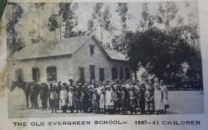
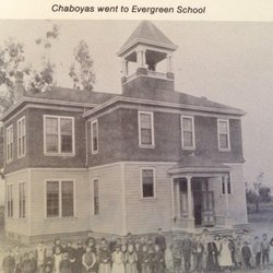
image001 The Evergreen Schoolhouse opened in 1860.  There were enough Chaboyas, both European and American homesteaders and rancheros families to open up a school in Rancho Yerba Buena.  It would be incorporated into the Santa Clara County Education system in 1866 as the township became more established.

markhamFamed author Edwin Markham (1852-1940) would come to Evergreen Schoolhouse to teach in its early days after attending San Jose State University.  Teaching in Evergreen from 1969-89, he would recall the days of a single story school house, replaced by a larger two-story one.  A nearby redwood tree was planted in his honor after teaching there for twenty years, which I intend to find if it’s still around.  The Redwood would be over 100 years old now.  It is said the Evergreen helps inspire some of Markham’s work.  The commemorative redwood tree also might be the inspiration of the Evergreen trees in the School District’s logo.

P1310885In general, the School’s schedule would sync up with the fruit picking seasons and operate 10 months a year.  They insisted on keeping the school free to the public and secular from its inception.  My old time interviewees would recall the school house at the corner or San Felipe/White Road and Aborn Road, then Evergreen Road.  That may seem odd now, but it would’ve been located there the shopping center and Valero gas station stands today.  The land was donated by Mr. Nirum Cadwallader, who also donated the same amount of land to the WCR some years later, and upheld the donation by William Matthews in the transaction to Geo. Kettmann.  Education has been something Evergreen residents have felt strongly about since the town began.  The Schoolhouse had been there on Evergreen Road, now Aborn, since the 1860.  I think it’s so cool that today’s well-known creek crossings would’ve been somebody else’s path to school 150 years ago.

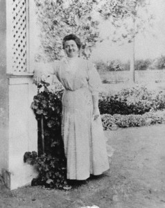
165) Kathrine Smithls1Katherine R. Smith (1870-1973), daughter of town leader and postmaster Francis J. Smith, would come back to Evergreen schoolhouse after being one of the first women to graduate from San Jose State University and teach down the street from her house.  The school house would remain there for a long time.  Katie is huge part of Evergreen History.

Charles C. Smith, F.J. Smith Store and Residence, Adam Herman,The two-story school house would be moved by rolling it over logs down the street on San Felipe Road and Yerba Buena Ave. during the 1950’s.  This is when San Felipe would’ve changed directions and Keaton Loop created.  Post World War and new City Planning developing in effect, Evergreen’s update began with this major move.  It also helps explain why this view of the Smith homes feels incorrect. From the drawing, the road now runs between the houses and business, and this driveway between them is essentially Yerba Buena Avenue.  Directly next to this road would’ve been Dry Creek, now known as Thompson Creek.  The Schoolhouse would come to stand where the General Store and Winery are.

P1310652That’s right, the schoolhouse moved across the street from Katherine’s House.  How rad is that?  Katherine, Katie, would become Superintendent of the Evergreen Elementary School District, watch the school outgrow this two-story facility and move to Fowler Road before expanding with new schools.  The Evergreen School is where Evergreen Elementary School is today.  Katie would live to be 103 years old and known as the Daughter of Evergreen.  As a staple of the Evergreen Community and a beloved educator, it only seems appropriate to name Evergreen’s second school in her honor in 1962.

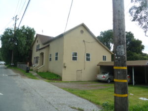
P1310650This two-story school house still stands today, or at least that’s what I had heard from fellow Evergreenians.  I did some digging.  I found what stands where the schoolhouse was last seen.  There is this odd, adobe looking, older apartment building, called the Chaboya Apartments, standing there now at the intersection of San Felipe Road and Yerba Buena Avenue.

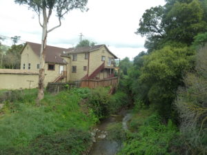
P1310647What I was not understanding or seeing before was that the Evergreen Schoolhouse does still stand, but with the addition to the original building disguising it.  I took a closer look at what was there and found the Schoolhouse I was looking for hidden in plain sight!  I find it here farthest to the right in the picture to the right.  It would be naturally to extend evenly in each direction, but you’re pretty limited in repurposing a building with a creek in your backyard.  To say it’s gotten some body work would be an understatement, but that’s it with the stairs leading up to it.  Only the front got the more modern adobe facelift.

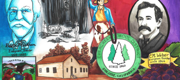
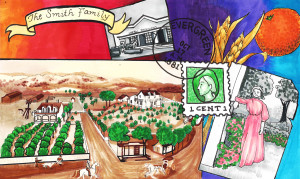
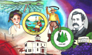
It’s an incredible finding as the Evergreen Elementary School District is an ally of The Evergreen Mural Walk project, as well as a source of its inspiration.  Education is something we’d like to focus on here in Evergreen and that strength came from within in many instances.  Katie is one of those inner strengths.  The students still living having used this facility are still a connected family here in Evergreen.  Here’s some of the artwork inspired by the early days of the Evergreen Elementary School District.

18701860