Category Archives: Historical Research

Sparkling Evergreen Waterways

P1310696
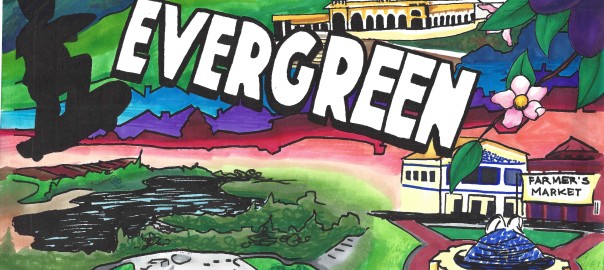
Throughout Evergreen’s over 200 year History, we hear described a network of creeks running though town.  As a kid, I would form a personal relationship poking around for toad and bull frogs, swinging from tires and racing over bridges with my friends.  Little did I know, these creek beds are a contributing factor to the name Evergreen.

hb896nb4gd-FID3

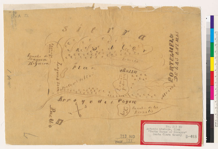
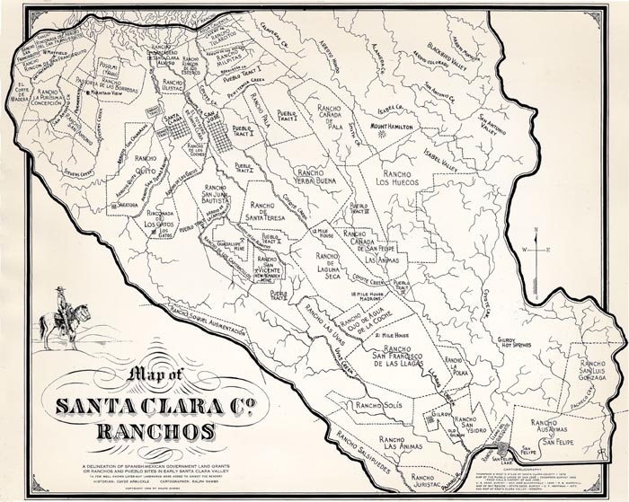
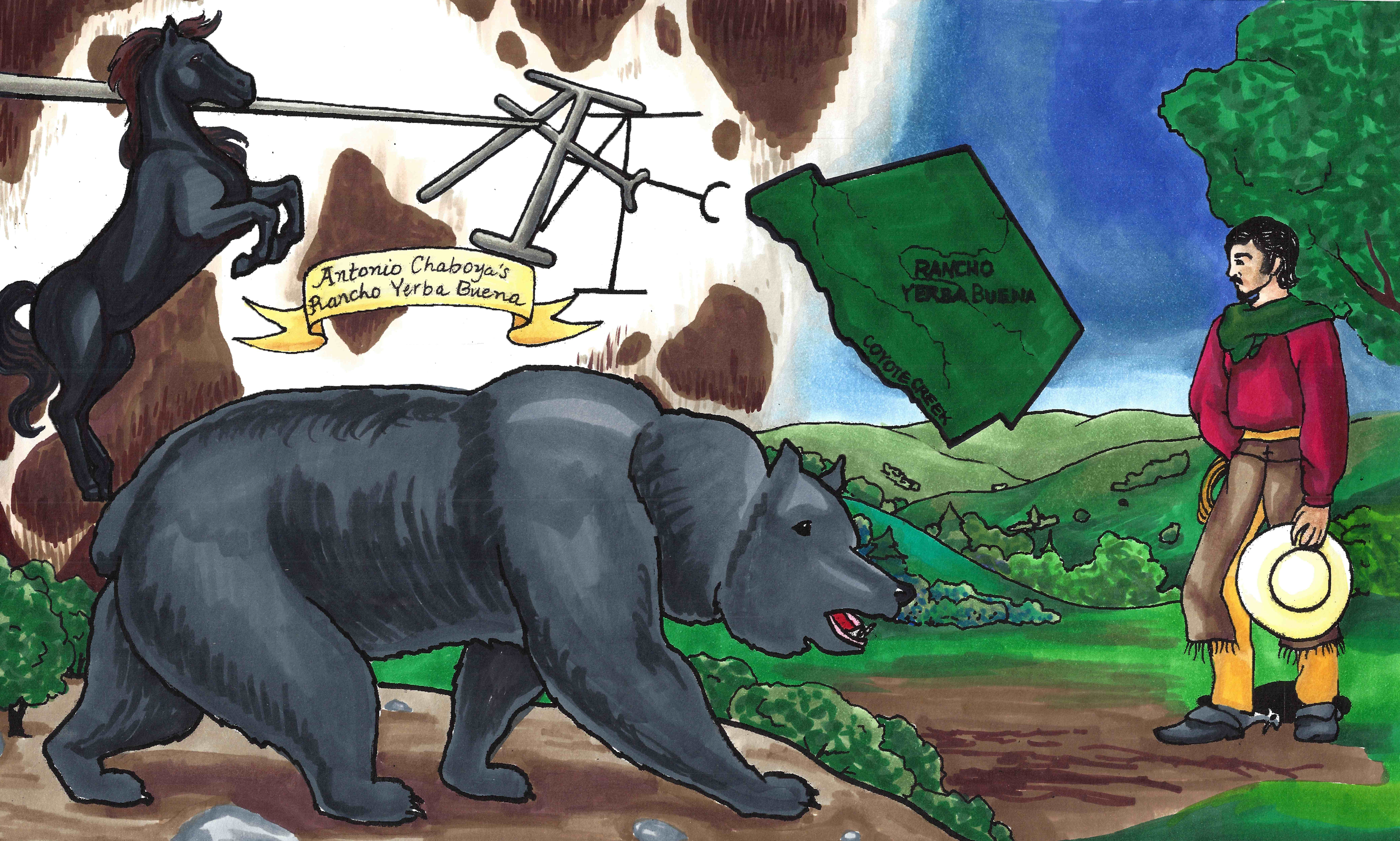
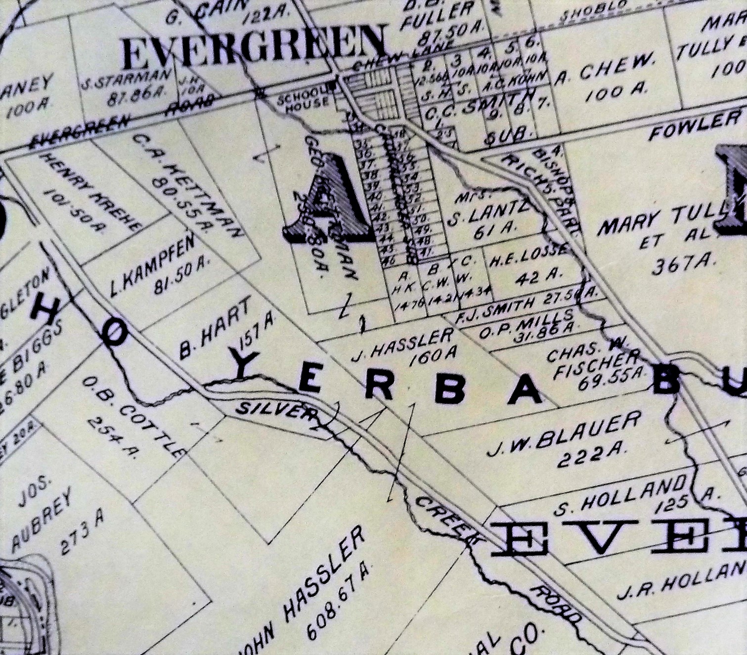
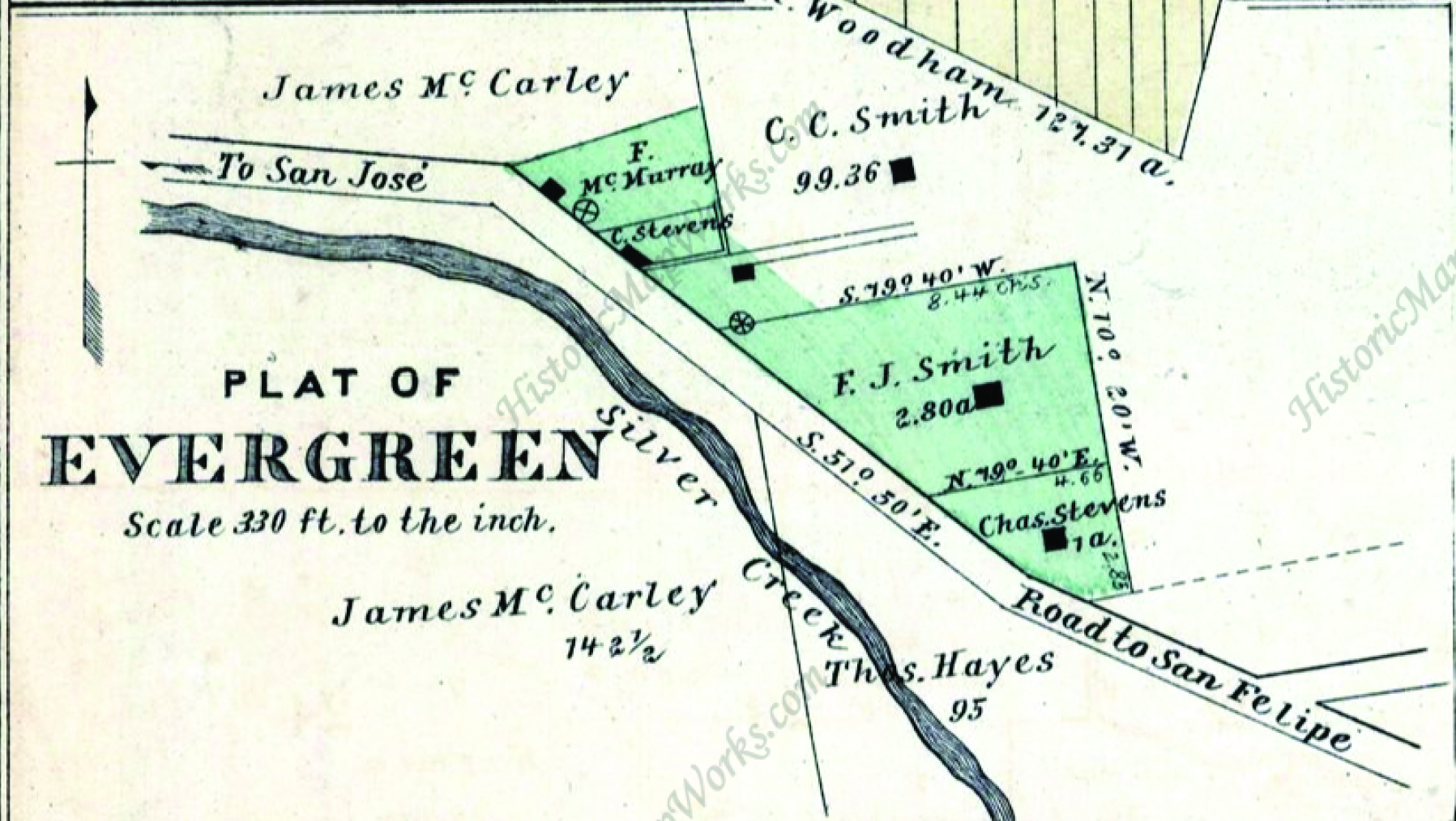
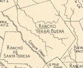
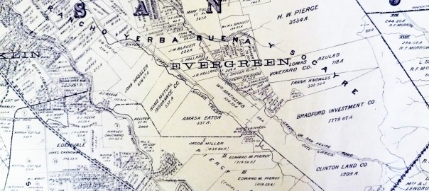
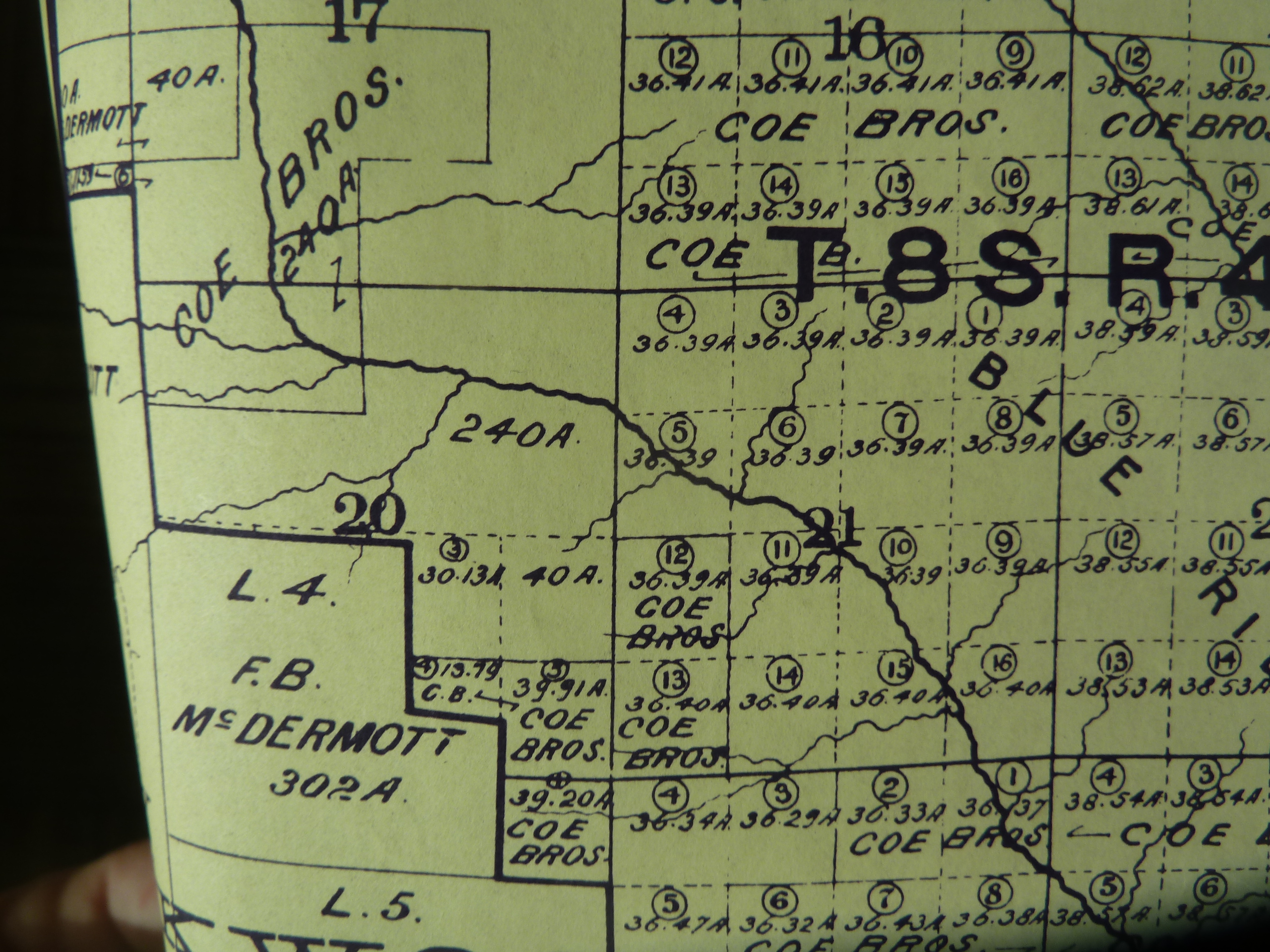
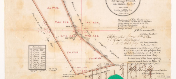
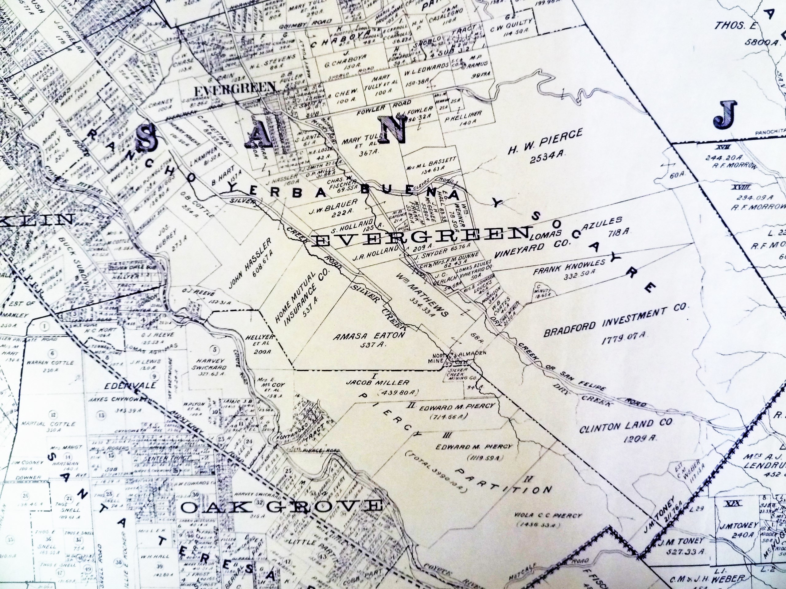
The Spanish and Mexican powers in California would call them the lagunitas.  The creeks ran off into the large laguna or lake.  Evergreen was rather marshy.  This Rancho Yerba Buena Chaboya Diseno notes several creeks running through the Evergreen hills.  This map especially notes Dry Creek, Thomspon Creek and Coyote Creek, the western border of Rancho Yerba Buena.

1876 Map
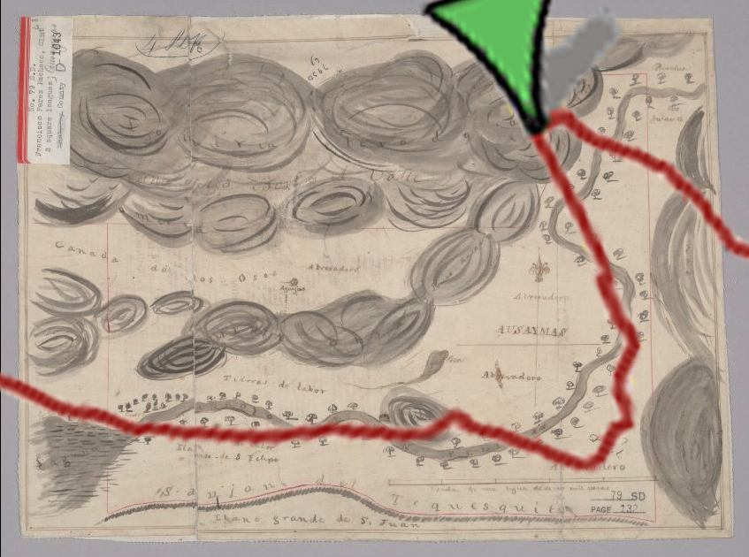
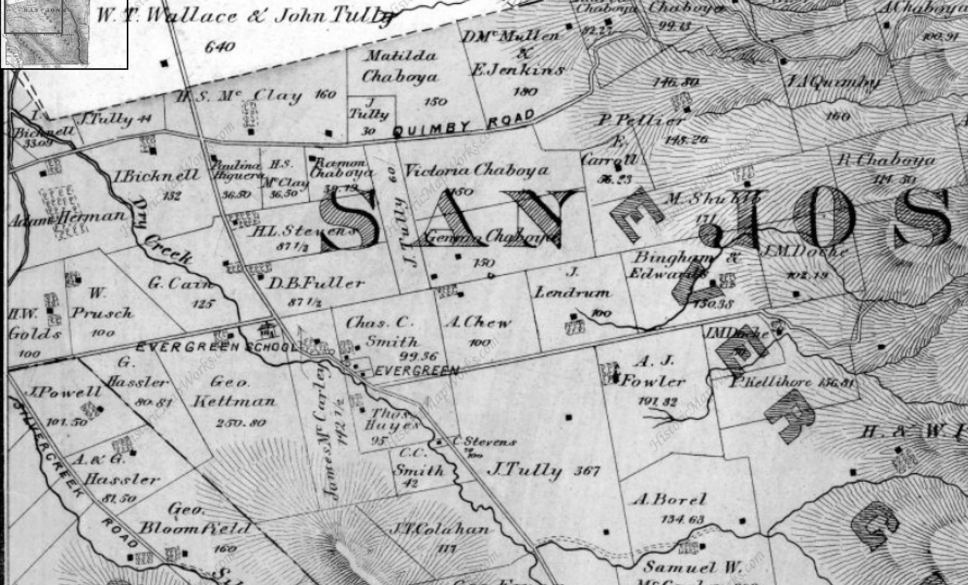
What the Mexican Chaboya land grant from 1833 doesn’t show contrary to so many other maps and disenos of this neighborhood is that San Felipe Road after the intersection with Evergreen Lane now Aborn Road run parallel to a large creek.  Evergreen was built around its creeks.  The town of Evergreen would built up around its creeks and learn to rely on them.

P1310622
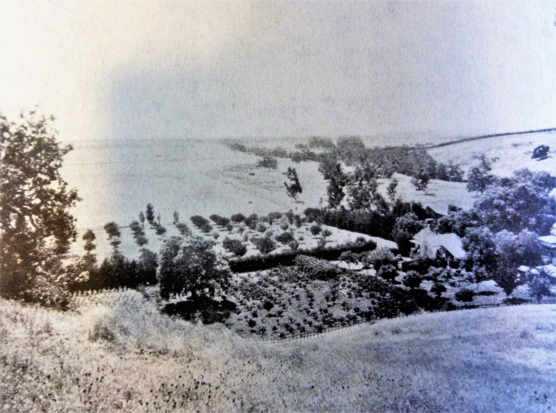
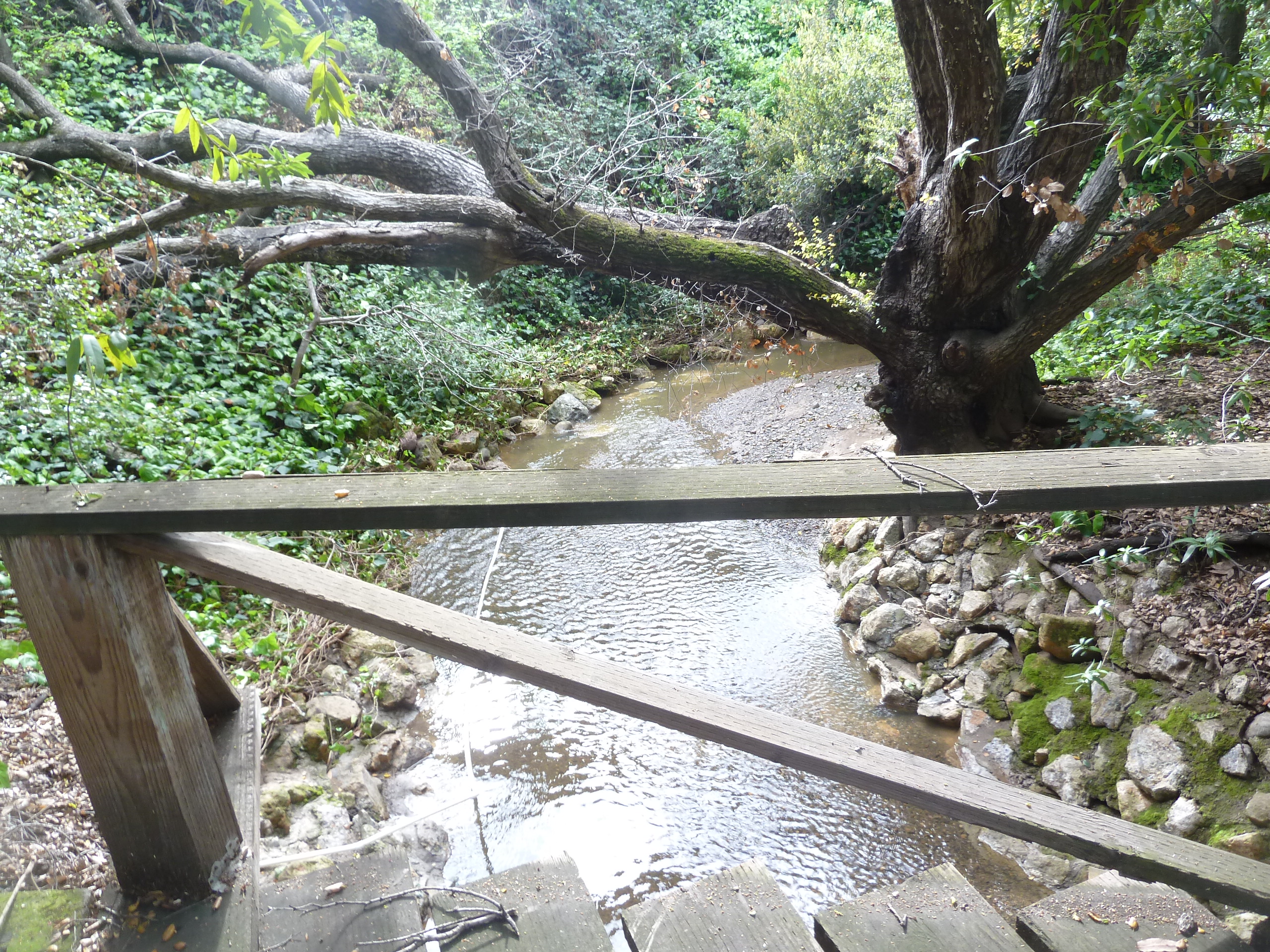
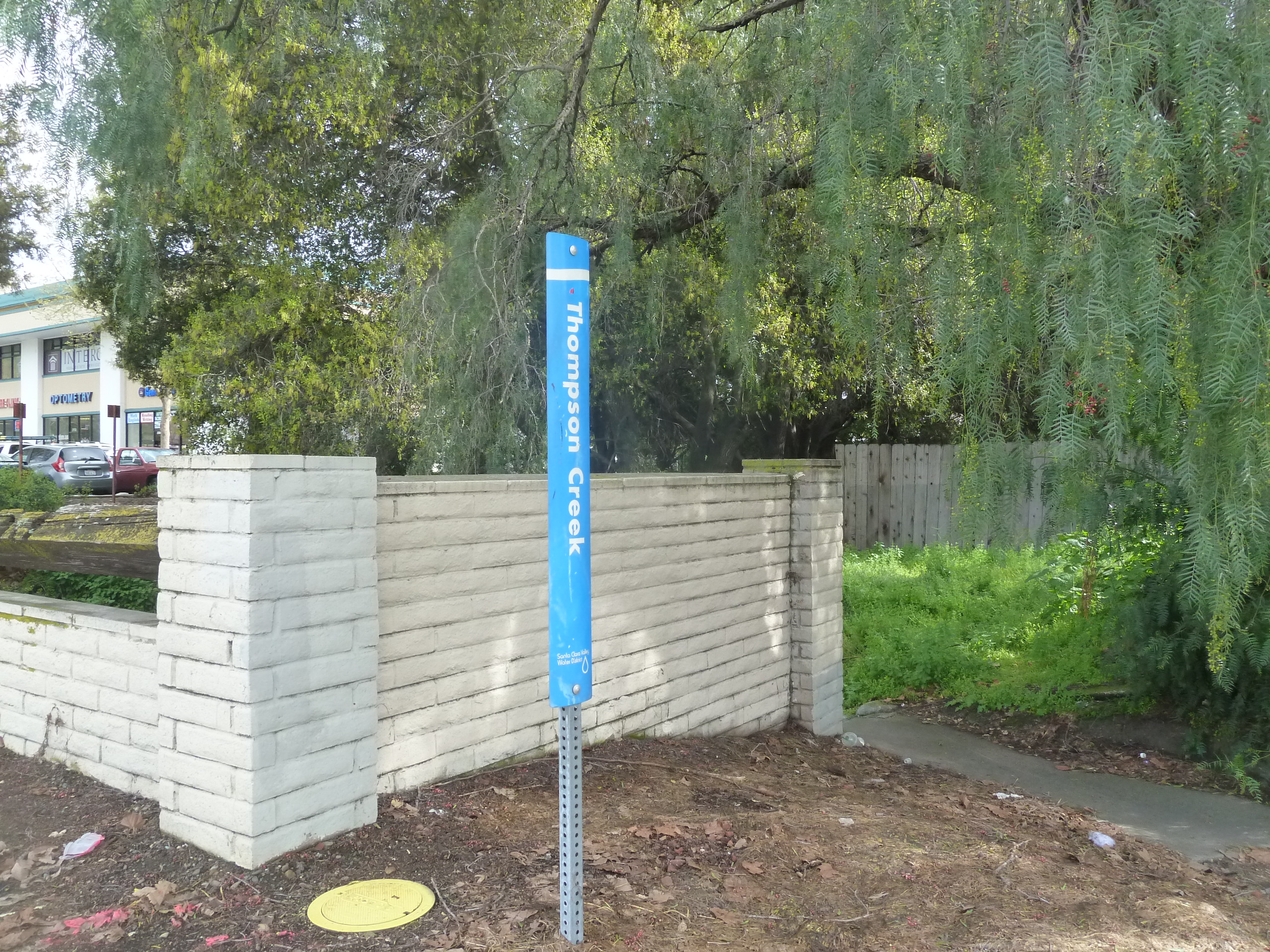
This creek to the left was once called Dry Creek.  Dedicated in 1974 as Thompson Creek, Dry Creek ran directly through the town of Evergreen founded in 1866.  It was amazing to hear that these bridges I crossed on my bike as a child would have been crossed for some 100 years before.  These bridges connected distance farmers and ranchers to the center of Evergreen.

P1310619The original path of San Felipe Road 150 years ago was parallel to this creek almost directly after Evergreen Lane.  Keaton Loop, which sneaks behind Wells Fargo on San Felipe was the original route, hugging the creek bed.  This route feels old timey as all get out.  The original schoolhouse would be located in the shopping center on the other side of this creek crossing.

1880 - Evergreen bridge
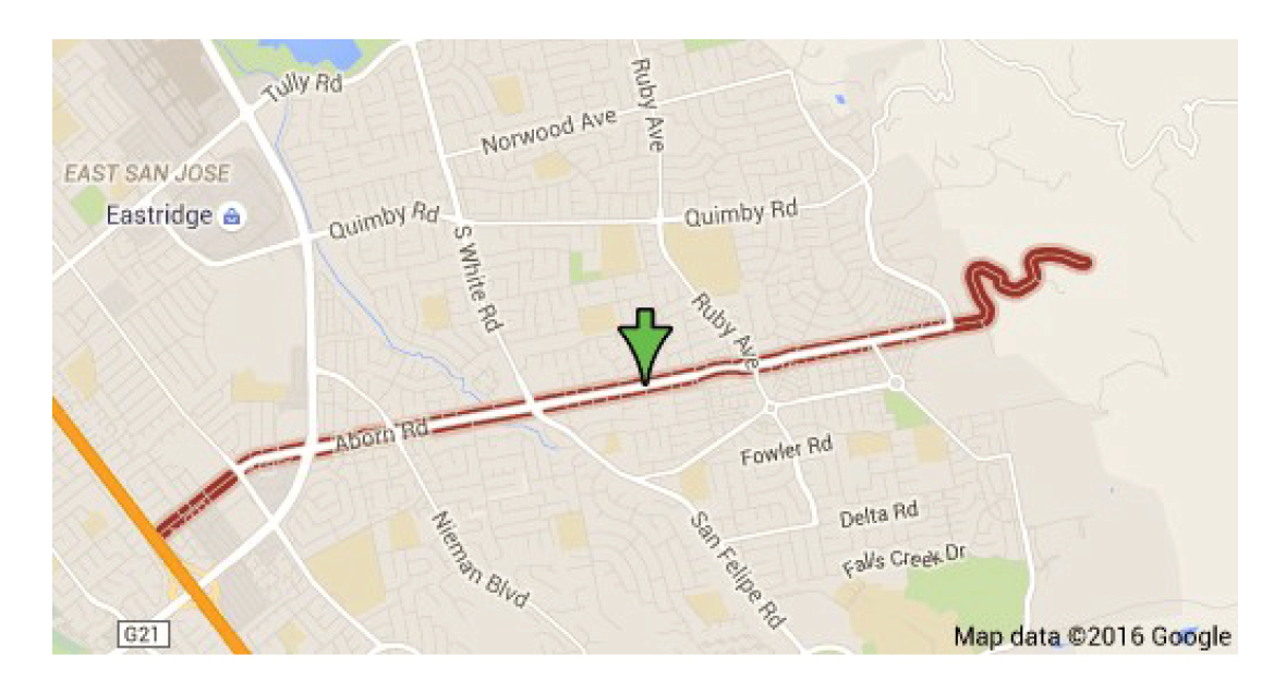
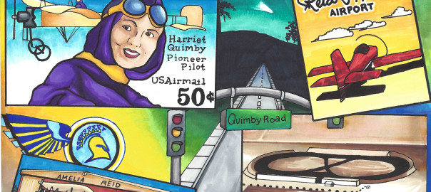
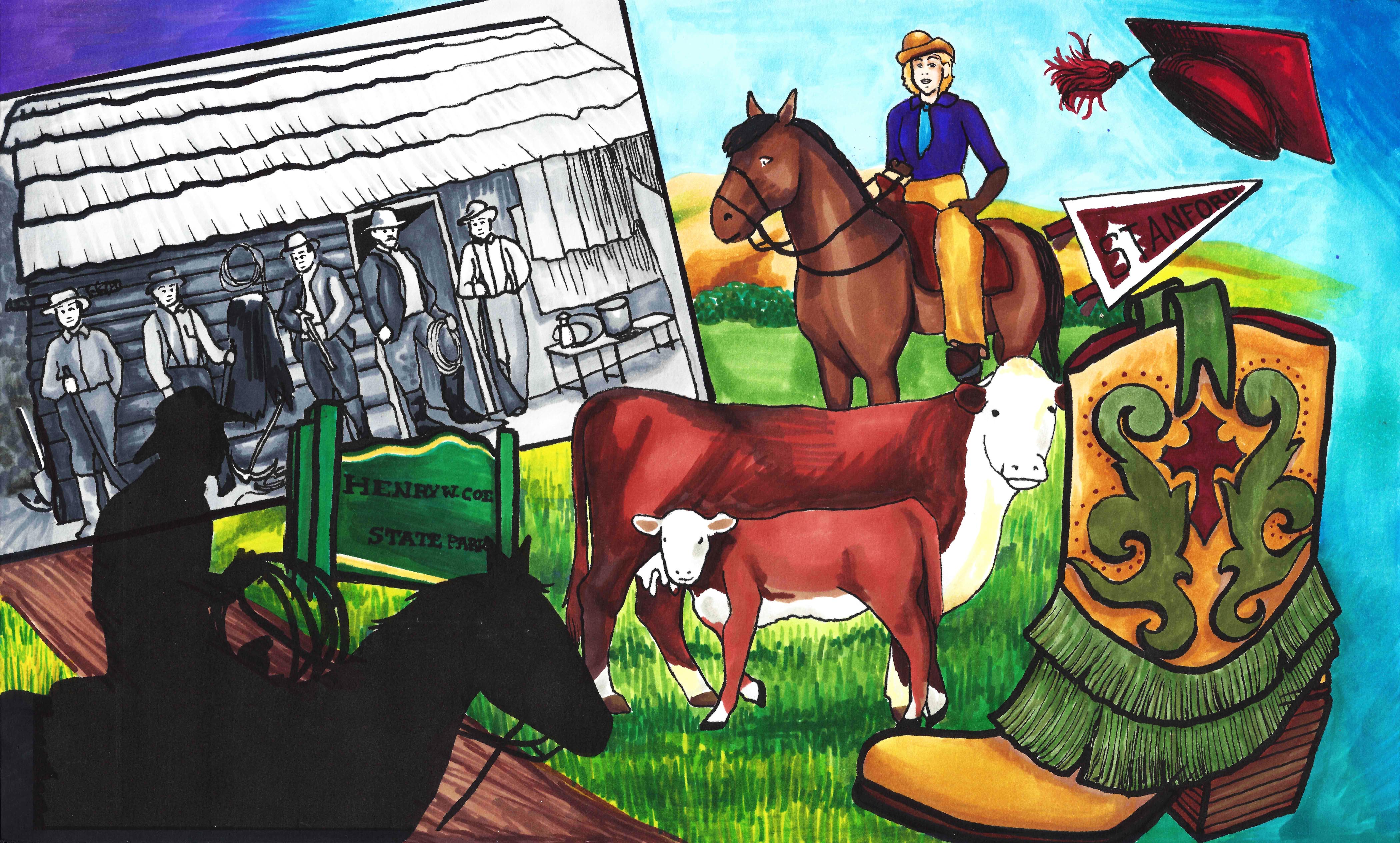
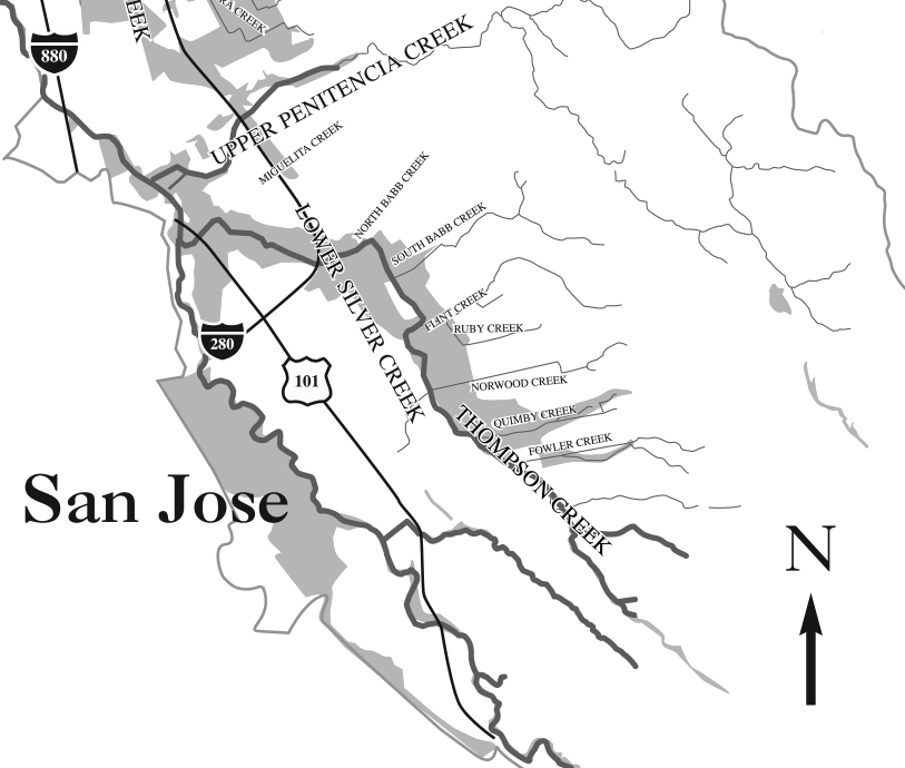
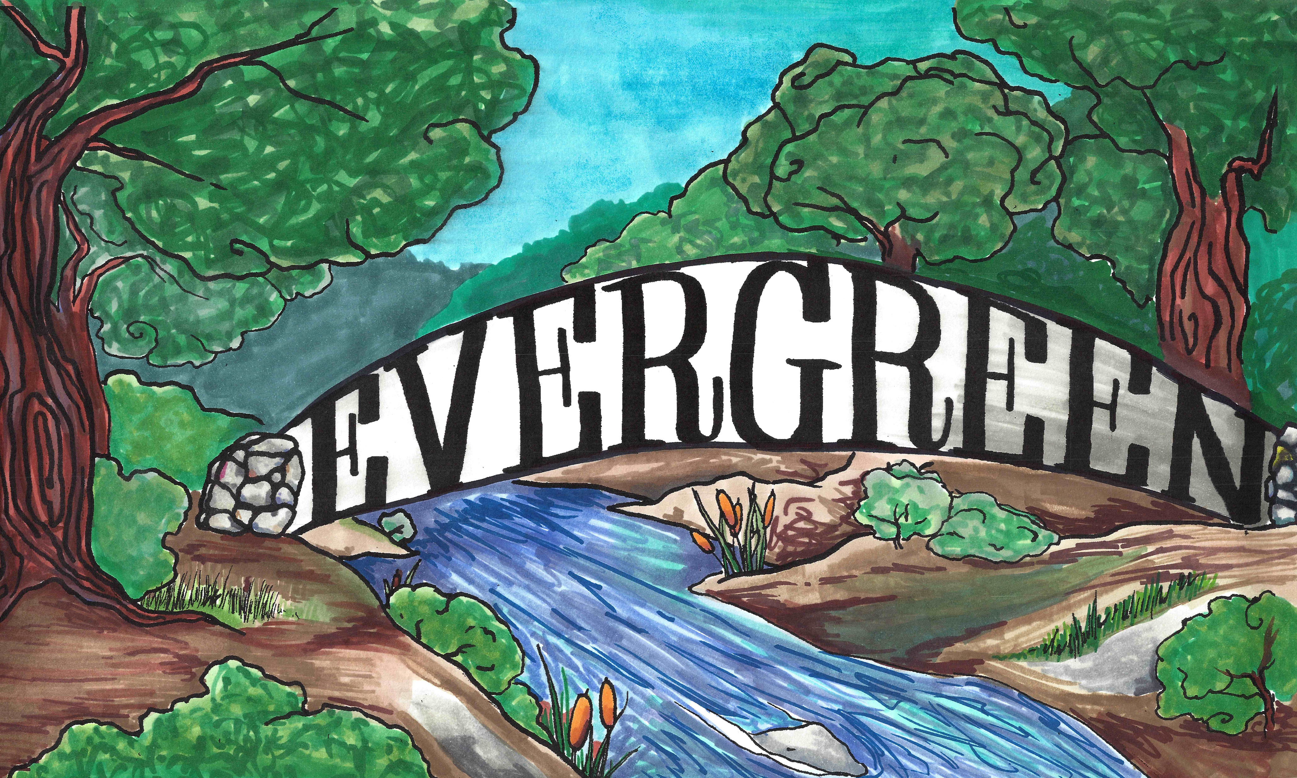
Most popular small crossings of Thompson Creek are between Cadwallader Avenue and Keaton Loop, to the south of Evergreen Lane/Aborn Road, and Scottsdale Drive and Pettigrew Drive, to the north of Evergreen Lane/Aborn Road.  These are both super close to White Road and San Felipe Road.  Students from 1860 would’ve crossed these bridges to get to class.  Thompson creek dumps into Cunningham after traveling parallel with Capitol Expressway a little.  It cuts diagonal after Quimby Road toward and past Evergreen Library.  Thompson Creek will loosely follow San Felipe traveling south until Yerba Buena Road.  There, the creek makes a left hand turn and hugs the Evergreen Valley College campus to its south.  Thompson Creek water ways have inspired this murals.

Dry Creek is what follows straight along San Felipe Road.  This was appropriately named as it run dry most times of the year.  Water from Anderson Reservoir would be pumped in to supply farmers with irrigation.  This would create family feuds over water right between neighbors.

velma_interior
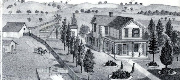
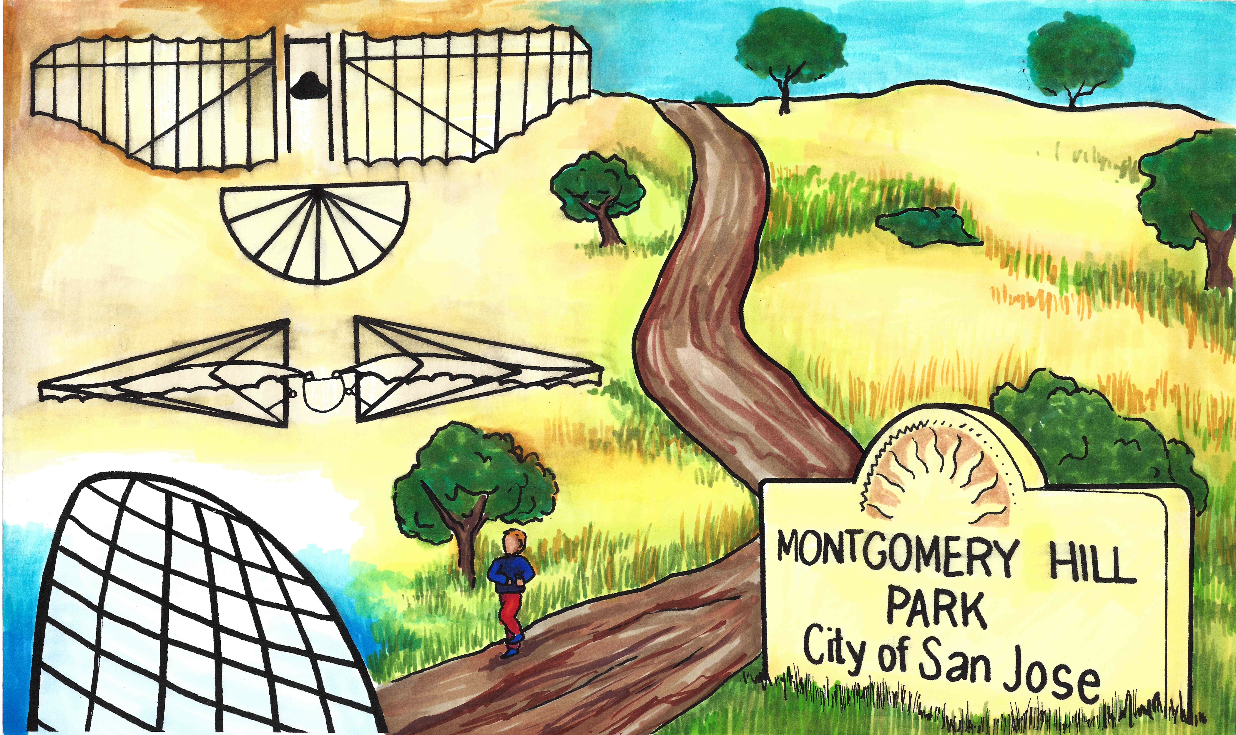
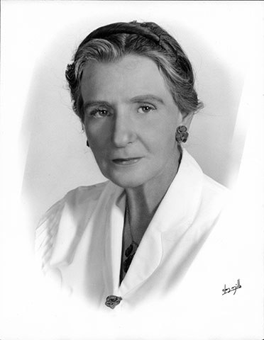
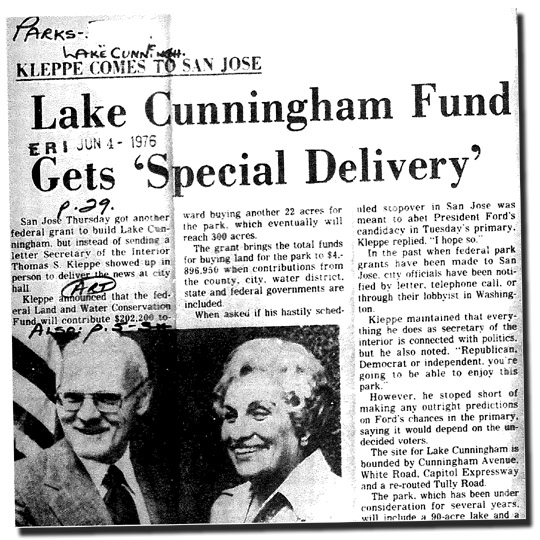
Back in the day, it was the Laguna Secrayre.  Lake Cunningham, before its new name and the creation of the park, was Silver Lake.  Velma Million, park creator, named the park after the gentleman who owned the land last.  Frank Cunningham purchased the land from Evergreen pioneer, John Tully.  City of San Jose had to seize the land in the early 1900’s for flood control.  As late as 1969, Silver Lake flooded its banks into neighboring low lying houses.  Today, this popular hiking and picnic destination serves a second purpose equalizing water levels.  Velma created the park in 1973, with a vision to create a “Vasona of the East” in a rapidly developing San Jose.  She created a positive from a negative.  Velma herself is truly inspirational to me, so we’ll save her story for another blog.

P1310197
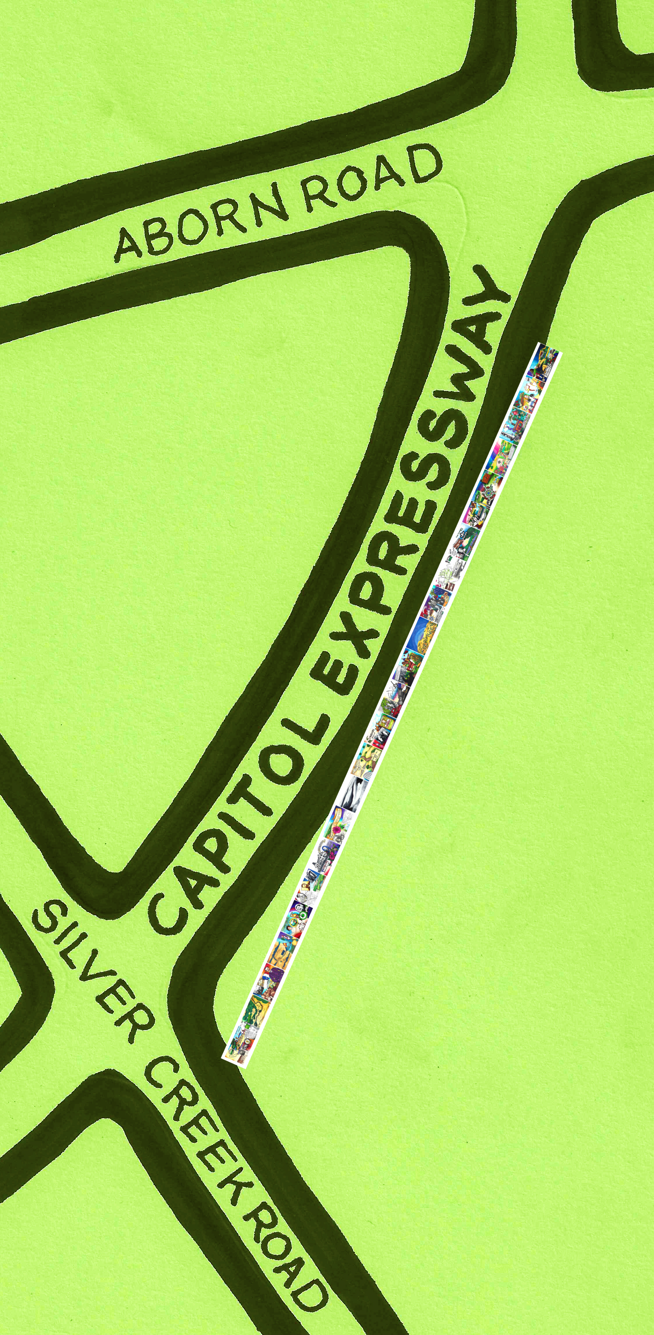
Silver Creek along the western side of old Evergreen.  It no longer exists today.  There are some traces of the Silver Creek around today, beyond the naming of the school and surrounding neighborhood.  Silver Creek was built directly on top of for Highway 101 and Capitol Expressway.  The ruins of Silver Creek can be found at the on ramp of Yerba Buena Road and US 101 North.

P1300931
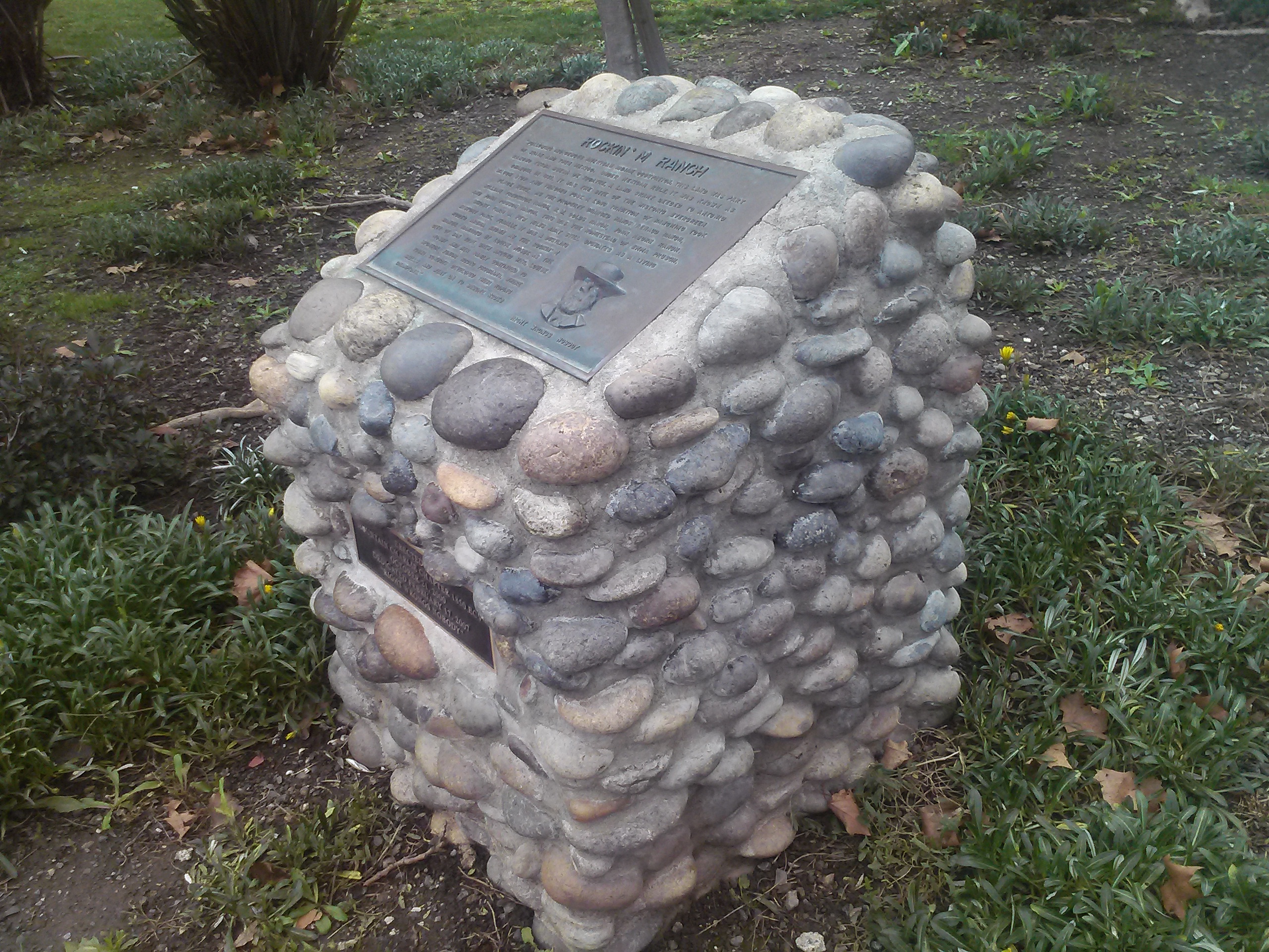
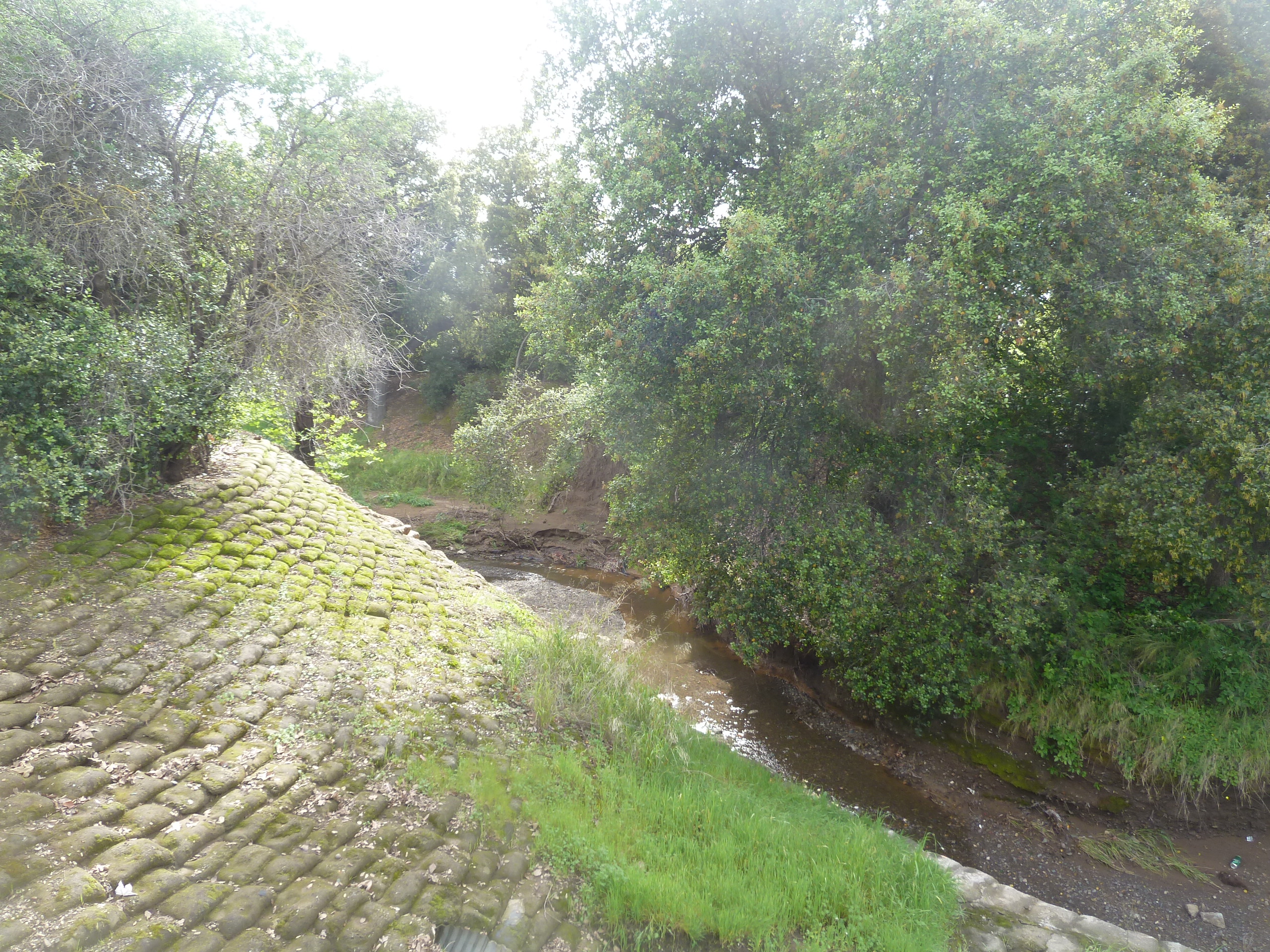
Silver Creek Road closely followed Silver Creek while it was around, but modern day King Road, which it turns into, does not.  Portions of Silver Creek exist near Silver Creek Linear Park.  Portions of it exist near new development in the old Hassler property now known as the Ranch, as well as along the backside Silver Creek County Club.  To the right is one of those relics of Silver Creek.

Norwood Creek, for which a school is named, flows from Capitol Expressway to White Road, then haults to an office center and residential subdivision.  It does reemerge in high elevations.  It has several Water Facilities along Norwood Avenue diverting this natural flow.  At one time, it would’ve paralleled the entire length of Norwood Avenue.

P1310632I suspect this what’s left of the Fowler Creek which, like the road, was named after farmer Andrew Fowler.  You can find this water way tunnel off of San Felipe Road  connecting with Thompson Creek, if you know where to look.  I think it’s actually quite stunning.  This creek would have split off San Felipe Road and followed Fowler Road east, but this area has been entirely developed.  On Google Earth, where Fowler Creek would’ve begun back in the day, there’s a large water tank.  Farming also could’ve dried Fowler Creek up over time.

watershed
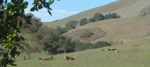
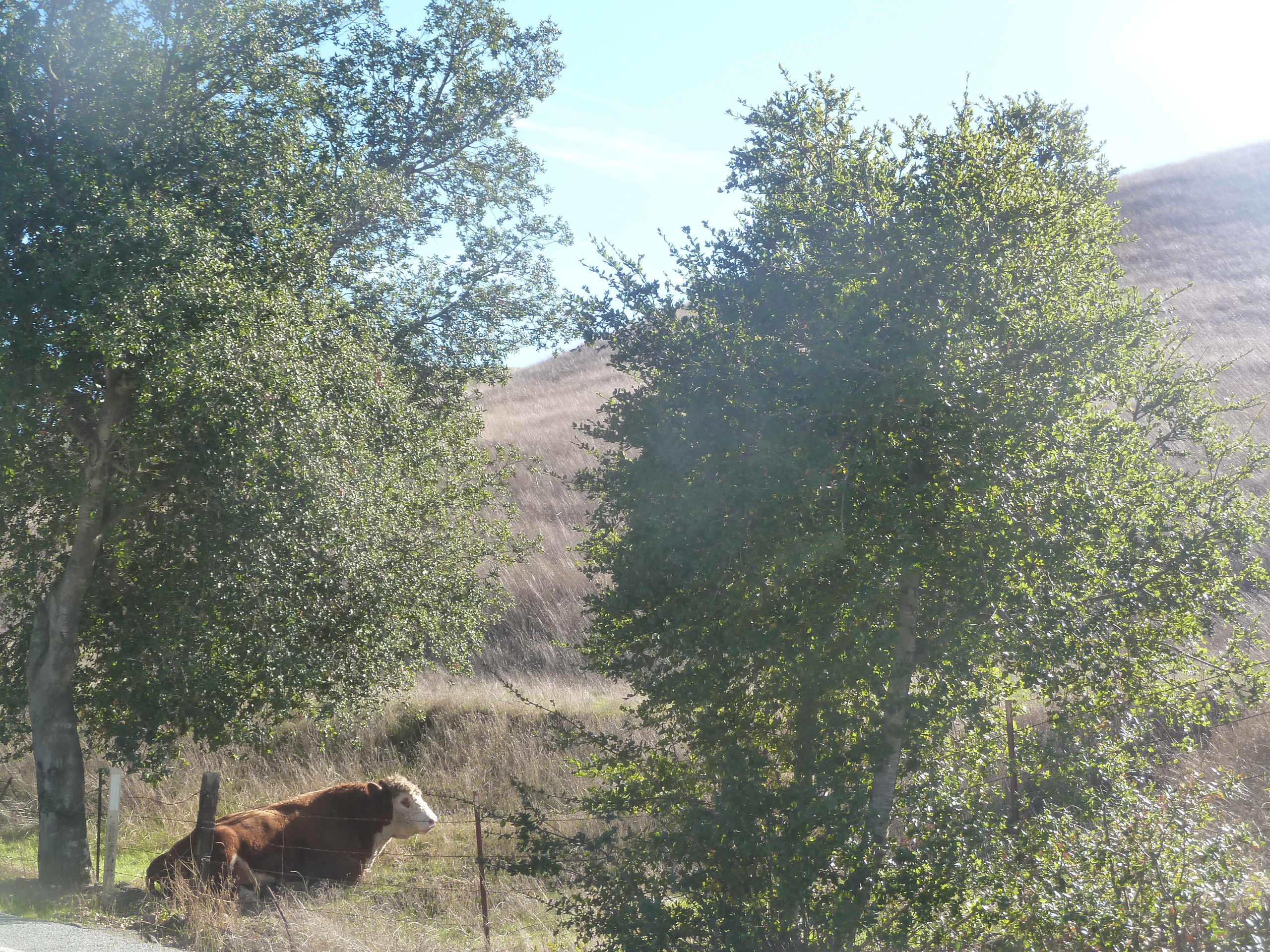
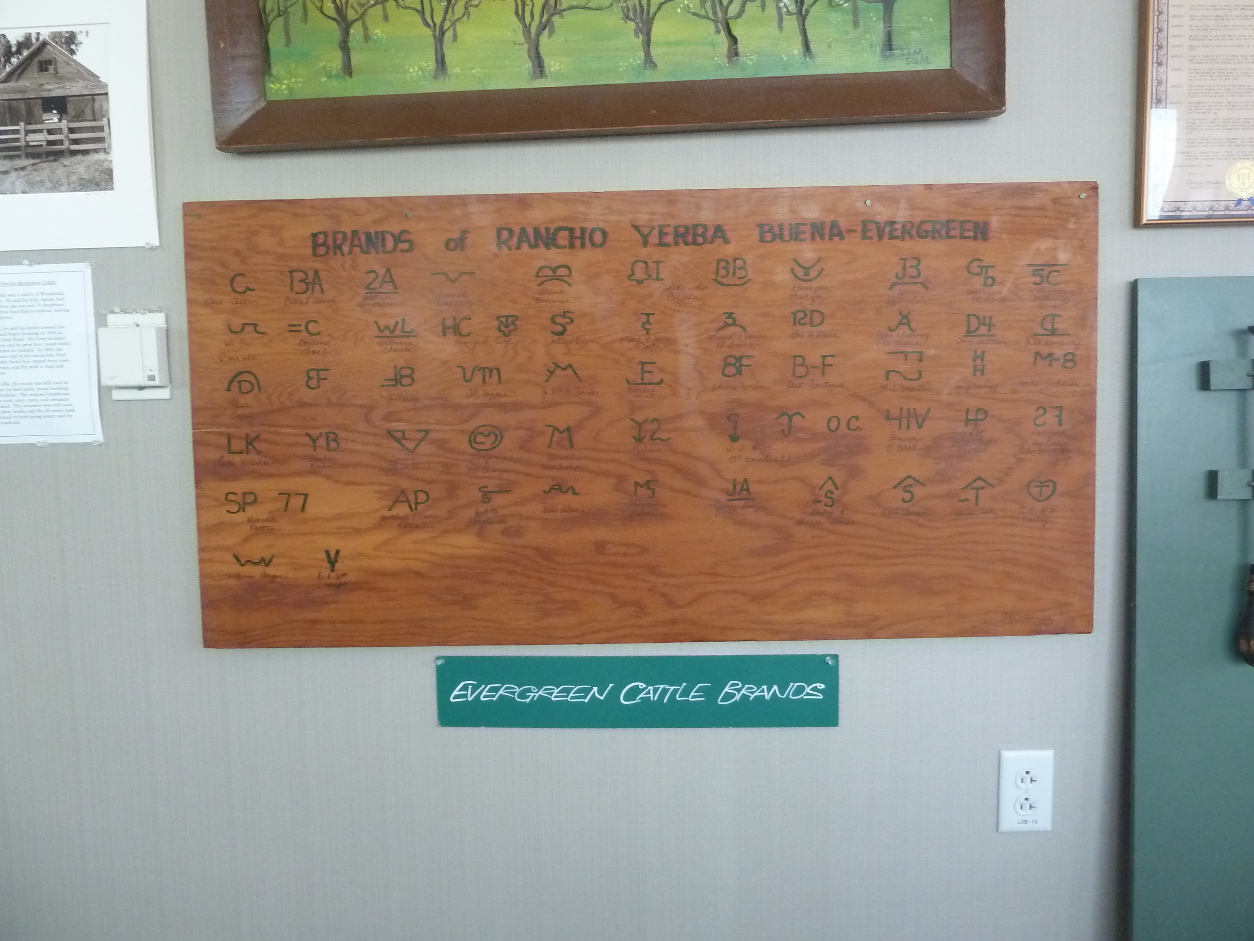
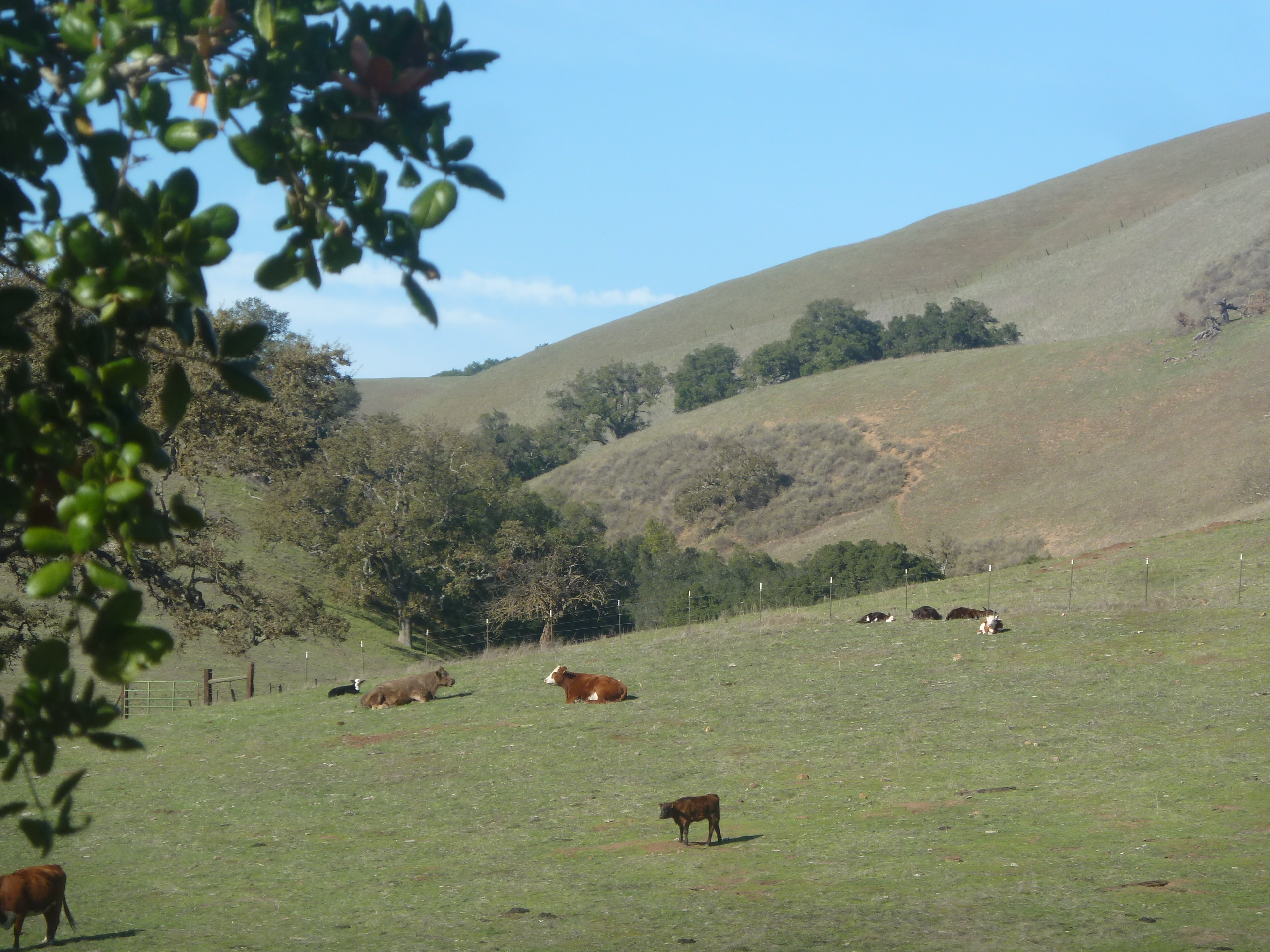
The creeks Evergreen all tie into a larger network the flow to either Calaveras Reservoir or Anderson Reservoir.  The Evergreen streams have been drying up for sometime, though.  Modern day Evergreen experiences golden hills in summer and autumn, but that was not always true.  Farming in the late 1800’s and early 1900’s found easy, dependable water sources close by.  These streams and creek would be diverted for orchards and crops.  Natural ponds would quench the thirst of cattle.  This and flood control measures lighten our hills in warmer months.  Drought doesn’t help.  The hills are especially lush lately.  Their naturally green grasslands were irrigated by running streams since the Ohlone Indians discovered Evergreen.

P1310599
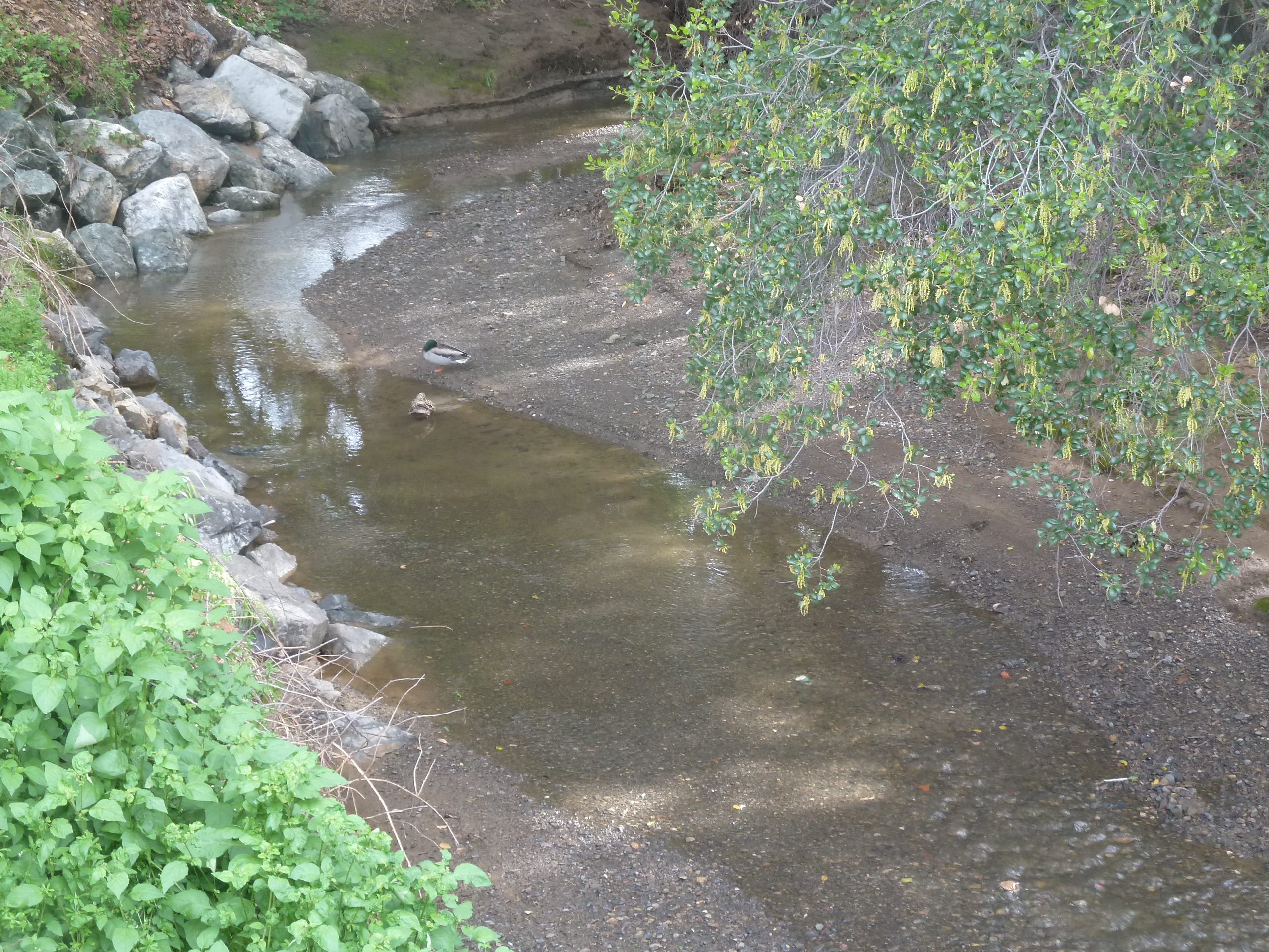
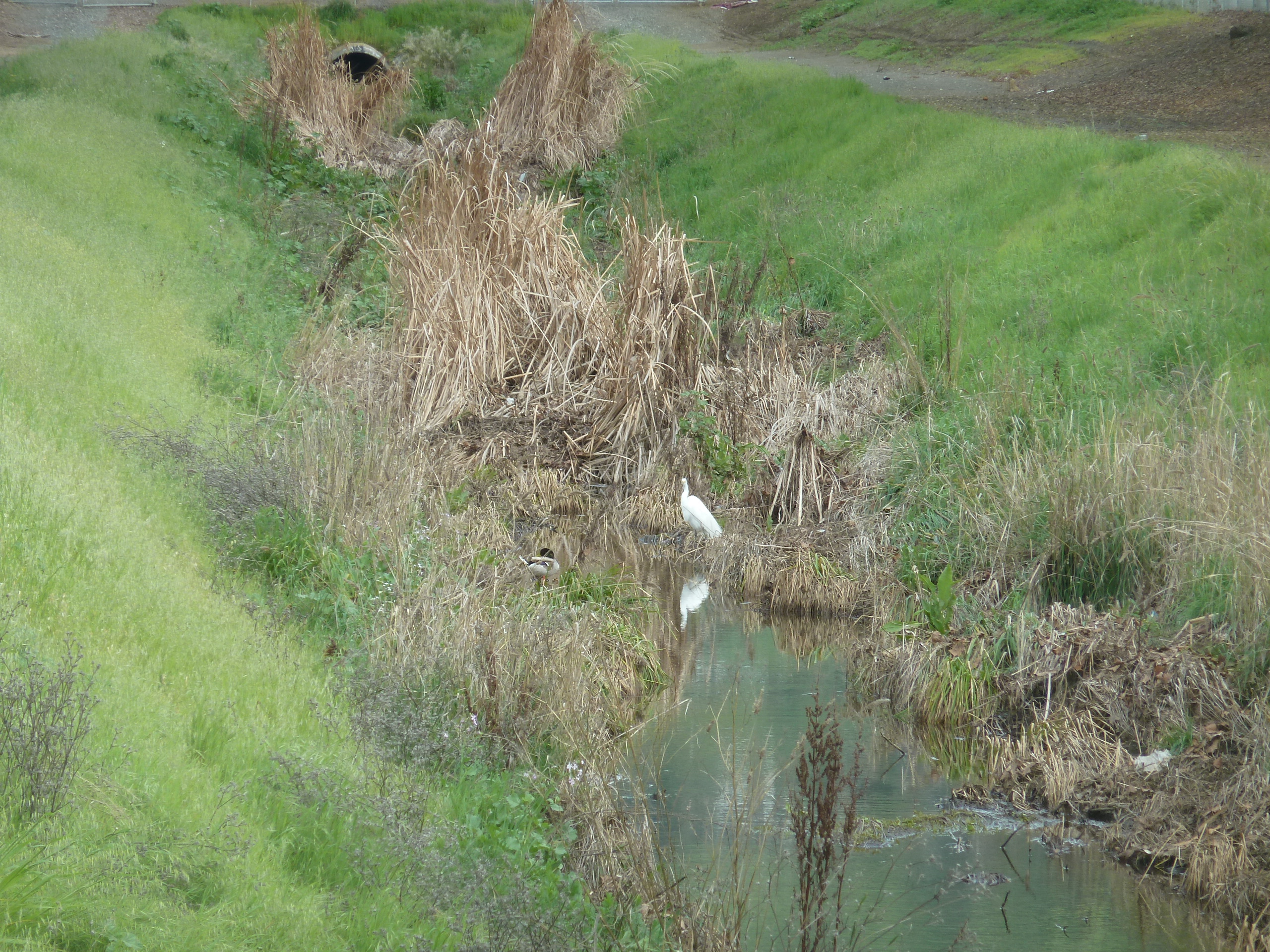
I went back to one of my favorite creek beds as a child, behind my old elementary school, Millbrook.  This is Quimby Creek, but as you can see and as I can hear late at night, the waterflow has a healthy wildlife.  The particular bridge connects Millbrook Drive with D’Amico Drive.  Quimby Creek connects to Thompson Creek with another quaint bridge from Scottsdale Drive to Aborn Ct.

P1300927
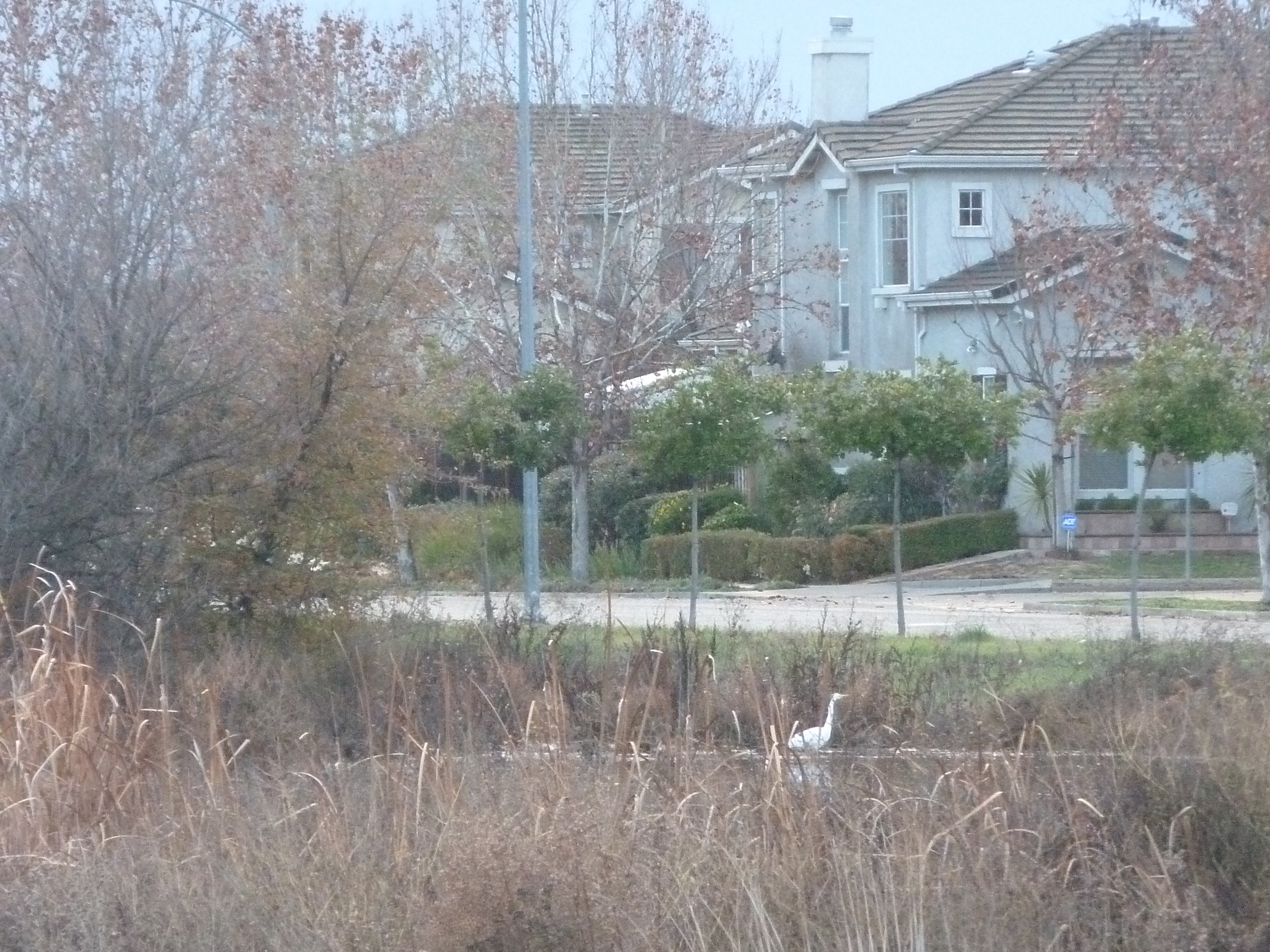
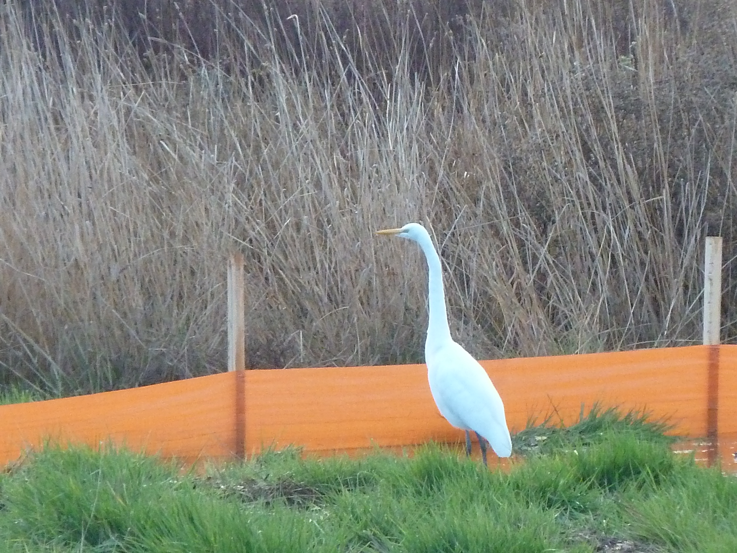
Egrets make a home in our healthy Evergreen waterways.  I used to see them all the time as a kid where Beschoff Motors is now.  They’re frequently by Capitol Expressway.  I found this guy over by Linear Park.

P1310608
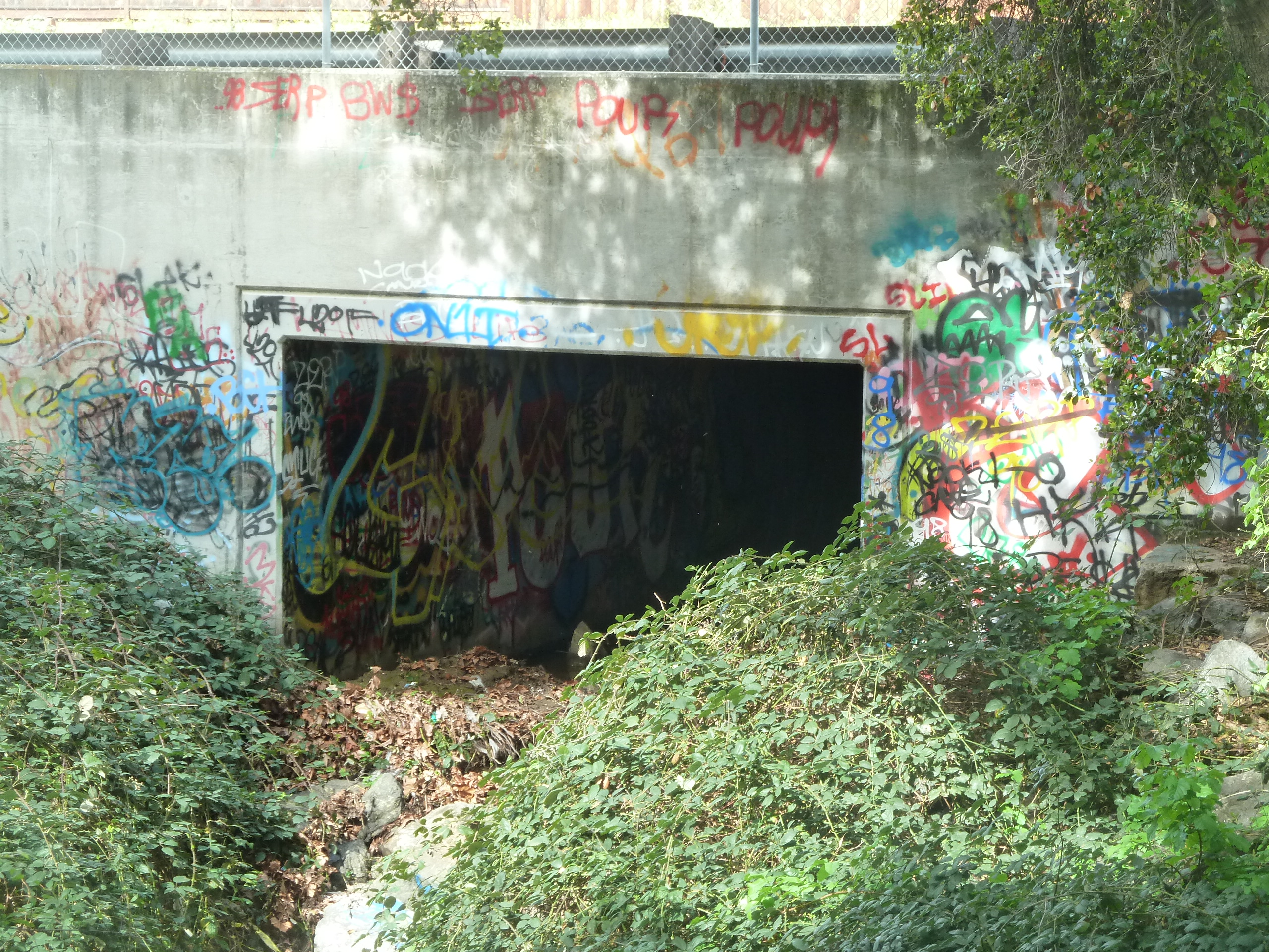
Sadly, many of the creeks and natural water flows have been built on top of, but should you be able to find them, you’ve found a little Evergreen History flowing in front of you.  Thompson Creek has a lovely trail, but it does feature tagging.  Consider tagging and graffiti also a part of Evergreen’s identity.  It’s just the fact.


Evergreen today

evergreen-realtorAs Wikipedia describes it, Evergreen is the neighborhood between the borders of Tully Road to the north, 101 to the West, San Felipe Road to the South and the East foothills to the East.  The artwork will revolve around the people, events and places within this area.  I’m portraying Evergreen overtime.  It begs the question, what is Evergreen today?

sjgurdwaraEvergreen is home to 126,146 documented residents with 34,151 households.  I phrase it that way because we have a lot of long-term visitors indoors and outdoors.  Evergreen is half as dense, people per square mile, as the rest of San Jose or San Jose as a whole.  We’re evenly split between men and women.  The average household size is 3.7 people.   Average household income in $135,206.  To say Evergreen is diverse would be an understatement.  It’s a melting pot brimming with different culture.

Our gorgeous suburb has an average age of 37.4 – 40.2 years of age.  I know you think of Silicon Valley types raising their kids in Evergreen, but the Villages Retirement Community tucked back into San Felipe Road tremendously evens out our median age.  The Villages is home to hundreds of old Evergreen families and pioneers.  It leads me to believe the bulk here is under 10 years old and over 70 years old.

68.5% of workers in Evergreen are White Collar workers, many of those folks working in the healthy tech economy of the Silicon Valley.  Almost 50% of residents have college and graduate degrees.  80% of residents in Evergreen have some college experience.  Needless to say, education is an important aspect of the Evergreen community.

images92JJUXZ6Evergreen Elementary School District and Eastside Union High School District have 18 public schools, 12 of which have a 9-10 rating as noted by GreatSchools Ratings.  I’d say that’s an excellent percentage.  All these schools have 5 or above rating.  Evergreen Community College hosts classes for more than 11,000 students.

Evergreen treesEvergreen was named for its oak trees, lush rolling hills and sparkling waterways that have existed here throughout time.  Though summer and autumn months bring a golden quality to our hills, open spaces and rural areas survive here in Evergreen as it was once a farming community.

Though the Evergreen Mural Walk is aimed at instilling pride into the Evergreen neighborhood by drawing upon its roots, it is a brilliant pocket of diversity and growth today that we should be proud of.

Ranching – a redundant theme

P1300620Evergreen has a lot of singularities  within its timeline but there are also some overlap in the stories here.  We know, and it will be discussed later, about the Valley of Heart’s Delight and orchards that once existed throughout Evergreen.  Winemaking makes an appearance in Evergreen in several places.  The lesser known and spoken about tradition of civil service and leadership will be portrayed throughout the artwork.  A past, present and continued theme and motif you’ll find throughout the Evergreen community is cattle herding and ranching.  This will be portrayed in the Evergreen Mural Walk artwork.

ranchosMapThe first cattle herders in Evergreen, and in California, would have been Spanish colonialists and missionaries settling the area.  Cows aren’t at all indigenous to California so the Native Americans would’ve been introduced to them at this time.  Pueblo de San Jose was established in 1777 in between San Francisco and Monterey naval bases.  Expeditions in the late 1760’s into Northern California would’ve necessitated cattle and enough food for the journey.  The trip from Monterey to San Jose would’ve passed through Watsonville, Gilroy, Evergreen and into the Santa Clara Valley.  This would begin the continued ranching culture in Evergreen.

1821This tradition would be carried by Antonio Chaboya and family into the Mexican Period.  Antonio would be granted Rancho Yerba Buena in 1833.  In fact, the Chaboyas held rodeos for young stable hands and farm hands which would foster a great relationship between boss and employee, as well as develop their skills on the ranch.  Though the Chaboyas maintained ownership into Statehood, squatters would eventually lay claim to the land saying that the property was extravagant grazing lands and the Chaboyas didn’t need, or have right, to all of it.  These allegations having the rights to the “American Dream” would empty their coffers and the Chaboyas would part with Rancho Yerba Buena and maintain smaller homesteads.

CAM09418One of the Rancho Yerba Buena squatters, John Aborn, having journeyed to America in 1833, would also host rodeos.  It would be a safe presumption that he, too, herded cattle in Evergreen.

The rodeos were more than a test of one’s riding skills and bravery.  What these rodeos would become in a spread out, rural town like Evergreen were an annual community celebration.  These would bring neighbors miles apart together and foster great relationships.  The Pueblo would become Downtown San Jose.  Large farms would exist outside of town or in other small towns.

coe_brothers_smallHenry W. Coe would move into Evergreen in the 1850’s, purchasing portions of neighboring Rancho los Hechos, which is the Hall’s Valley/Mt. Hamilton foothills area.  Henry Coe’s ranch would eventually extend through the Evergreen hills and into Gilroy.  The Coe Family and herd would maintain these hills for several generations.  Structures in Henry W. Coe Park, lands donated by Sada Coe Robison, were on the far end of the property.  The cattle would graze here into the 1950’s.  Hewlett and Packard families would buy acres of this pristine, untouched grazing last and preserve it for future generations.

6254956674_f8ffe7d622The Kettmann family would move into 2 neighboring Evergreen ranches in the 1870’s, harvesting orchards and grain for the most part.  Generations of Kettmann farmers would also work a small vineyard on the property.  The large German family also maintain a healthy swath of grazing lands in Mt. Hamilton foothills for their sheep herd.  The Kettmanns still own the property til this day.  The fluffy herd would travel through town from the Kettmann Ranch, near Evergreen Library, and into the Mt. Hamilton property for generations of ranchers.  This set of Kettmann brands were donated to EVC for its collection.

P1310148

P1310154 Evergreen Valley College has collected most of the ranching brands from the area for its Heritage Room, found in a side room at the Library Facilities.  The Heritage Room was curated by Evergreen Times contributor Colleen Cortese.  Evergreen Pioneer families would donate to the museum room.  Ranching would be a constant in the Evergreen Valley and hills.  Here, they’ve displayed the unique brands from each ranch.

68715_1417634796_bsb_case_barry_swenson-2343-largeRanching is a tradition upheld by many old time Evergreen families, like the Richmond  and Swenson Families, who maintain cattle ranches today.  Why do you think Barry wears the hat?

P1300629People needed beef, and especially back in the day.  The result today is naturally groomed and overall untouched grasslands all over Evergreen.  The fact that the Silicon Valley doesn’t look more like San Francisco is incredible to me.  Thanks to our civil leadership and awesome Evergreen business people, Downtown San Jose remains densely populated and Evergreen gets a little elbow room, despite development.  We have the most beautiful climate, the most Recession proof economy, and open space.  To be born here is a miracle.  Happy cows indeed.

Road to Aborn

location greenAborn Road is one of our main arteries in and out of the Evergreen neighborhood – running east to west, intersecting with Ruby and Murillo Avenues, White and San Felipe Roads as well as Capitol Expressway.  It’s very close to the project site.  Just a stone’s throw away from our murals.

In the research and design phase of this project, I looked into all the street names around Evergreen.  It’s a little lazy, but a decent starting place if there was an awesome story to go with it.  The boundaries are consistent through the cartographical research.

It would be safe to assume Aborn was someone important, right?  I combed physical and electronic records for signs of John Aborn.

CAM09417Records of John Aborn’s journey to the United States date back to 1833 with some other notable European San Jose Pioneers from England by sea.  He was also sited in the case Anotnio Chaboya brought to suit naming squatters and evicting them.  His daughter Mattie married John M. Murphy, son of the Pioneer, and then notes for John Aborn dry up.

CAM09418There’s a monument placed at the site of his ranch, where community rodeos were once held, but nothing further on this John Aborn.  I don’t know if this portrait is supposed to be him.  His ranch would become William Prusch’s, whose daughter, Emma, would donate and become the namesake of the farmstyle park in East San Jose.  William would eventually turn it over to H. W. Golds for another farm.  I looked for family members of Aborn’s ranch manager, but alas, no leads.  The story Dead Ends, but he must’ve been a well-liked man for people to have remembered him in such a large way.

aborn road - Google SearchMost notably, Aborn Road had been home to Mirassou Vineyards, winery and tasting room on Aborn Road for many years.  The vineyard property is now new home developments.  Aborn begins in luscious hills and rural ranches.  Aborn ends at highway 101.  Today, it is home to shopping centers, the Aborn Village Square, hundreds of homes (which include some historic subdivisions), and the Evergreen Library Branch.  It’s a major Gateway through Evergreen.  I drive it nearly every day.  As a kid, I would cross it at various points using bridges over creeks and stop signs.

0-0-0This Evergreen roadway wasn’t always called Aborn Road, though.  San Felipe Road kept its name but not its route along Dry Creek, later Thompson Creek.  This made it difficult to place historical sites.  White Road would remain true to its course and its name throughout time.  Aborn Road has been a consistent gateway into downtown Evergreen.  I reviewed over 20 maps preparing for this project.  The same road shows in some form or another in all the resources, but has had different names through the years.  Until I looked at them in chronological order, I thought I was going crazy.  The maps weren’t lining up for me.  It wasn’t making any sense at.

J.E. Brown, Theodore Lenzen Residence, Geo. H. Briggs, J.E. RucThe Mirassou wine family would purchase 100 acres of real estate from farmer Alfred Chew in 1911.  Before Aborn Road was called Aborn, it was Chew Lane.

Alfred Chew, Sr., was born in 1834 in Ohio, making his way out to California in 1859.  Alfred would raise seven kids on his Evergreen Farm, one daughter becoming an Evergreen teacher.  The Chew Family would reside in Evergreen for over 50 years.  In 1860, Alfred Chew would buy his farm from William Matthews, an attorney of the Chaboyas.  Alfred Chew would be elected to the County Board of Supervisors in 1873 and serve until 1878.

P1310192Honorable Judge Kettmann did the paperwork for the Chew family in the sale of their historic property, shown above, before his judgeship.  The Kettmann’s, too, would live off Chew Lane for several generations as well.  The Hassler property would reach Chew Lane at one point.  The Tullys would own property here, east towards King Road and down White Road.

Before Alfred Chew moved into the Evergreen neighborhood, the path was simply known as Evergreen Road.  This roadway was the main road in and out of Evergreen for over 150 years.

1876 MapThe first Evergreen School house would sit at the corner of San Felipe Road and Evergreen Road, where there’s now a gas station and shopping center.  The series of walking bridges connecting the communities separated by lagunitas or creekbeds, were the connective tissue of Evergreen.  The Saloon was at this corner, down the way a little.  The general store was here.  The postmaster was here at this intersection.  The new school house was relocated on San Felipe Road.  This quaint downtown at Evergreen Road would’ve been where neighbors ran into each other.

Map 004, Saratoga, Evergreen, Santa Clara, San Antonio, Mountai6237991695_9e7a65829f_oEvergreen Road was once a driveway that  split the Smith Residences down the middle at San Felipe and White Roads.  This was the original Plat of Evergreen to the right.  Charles C. Smith would open the General Store.  The Smith House still stands today on San Felipe Road.   I’d love to see it turned into a museum or venue of some sort.  Nearby, the Hinman Garage is the location of the Smith blacksmith shop.

Screen Shot 2015-11-02 at 5.59.57 PMBefore that, it would simply be grazing land for Chaboya cattle.  This was a portion of Rancho Yerba Buena that ownership was contested.  Popular Evergreen Pioneers were involved in the suit, so I don’t want to go too far into it.  In the end, the squatters won.  The Chaboyas exhausted funds evicting and fighting for their land claims.  The squatters won the right to buy the land at a fair rate.  The Chaboyas maintained ownership of what they had left, but had to grant portions away to settle legal fees.  Before that, it would be Ohlone wildnerness.

Although the trail for John Aborn fell cold, the story the street tells is entirely awesome.  Evergreen is a place that transitions with the times.  It’s an ever changing identity.


Evergreen Sunsets

I have to tell you, one of the most charming things about Evergreen is the consistent, stunning sunsets.

Due to coastal breezes bringing wispy clouds from the Pacific and a haze of pollution exactly west over the highways, Evergreen marvels in pink and purple clouds nearly daily.  Our hills let us climb up and see the sun set over the Silicon Valley landscape.  Here are some of my favorites from my research photos.  I would take a drive through our gorgeous hills when experiencing writer’s block throughout the creative process.  Inspiration and Evergreen beauty would find me on these refueling drives.


Follow up – The Way to San Felipe

The Way to San Felipe, our previous article , talked all about this old Spanish Road and what it connected.  I got a little more clarity from an Evergreen Native who knows it from experience.

hb267nb0kh-FID7White Road changes to San Felipe as it crosses Aborn Road.  It cut in half Rancho Pala, which was purchased by Charles White, who arrived in town in 1833.  Only a sliver of this Rancho makes it into our Evergreen borders.  Rancho Pala ends at Norwood Avenue.

Further down the road, present day Aborn Road has had many names, Evergreen Road, Chew Lane and Aborn Road.  That inconsistency makes orienting yourself on different maps a little difficult.  It is at the intersection of Evergreen Road and White/San Felipe Road where the town of Evergreen really developed.  You’d never know it by the looks of it today.

Quimby and Tully Roads have switched spots and Capitol Expressway is a fairly new roadway.  This makes it rough, too, but it’s okay.  We’re talking about San Felipe Road here.

san felipe roadsPreviously, I worked the current Google map of San Felipe Road against an old Spanish Survey to Rancho San Felipe.  They were close enough for me to feel like I was looking at the same roads.  I accounted for some inaccuracies because it’s so old.  The lake is Lake Cunningham, but ought to point North and doesn’t.  The compass notes rather where water flows down from.

1876 MapAlso, in 1800’s versions of Evergreen maps, San Felipe Road travels next to a creek bed and I couldn’t think of where that would be.  The Creek is closer to Kettmann Road and the Evergreen Library Branch.  But when I sat down with Evergreen’s Judge Jerry Kettmann, he brought a little more light to the subject and old geography.  This is a 1876 Map of Evergreen.

P1310197Judge Kettmann’s uncle, Andy Kettmann owned a Saloon located on San Felipe Road.  There are some pretty awesome tales out of the Saloon, but I won’t be spoiling those or Jerry’s interview for you at this time.  His Honor comes from a long line of colorful characters, though.  He took me for a little drive and helped me get an understanding for what “Downtown” Evergreen was.  This is a Map from 1902, true to North.

Map 004, Saratoga, Evergreen, Santa Clara, San Antonio, MountaiThe Smiths were the first family to have moved into town in 1866.  Charles C. Smith and his brother, born in Germany in the 1840’s, bought large tracts of land from the Yerba Buena land grant, with Evergreen Road dead ending at White/San Felipe Road originally.  The Stephens/Stevens family were next, making up the original Plat of Evergreen.  Francis Joe Smith owned and operated the General Store and was postmaster.  His brother was the town blacksmith, and the blacksmith shop is where Hinman’s Garage is today.  His daughter Katherine, for which there’s a school named, was a beloved teacher.  L. C. Smith’s house still stands today.  Their homes and businesses were right off San Felipe Road between Aborn Road and Yerba Buena Avenue.

P1310192Speaking of teachers, the location of the school house was a mystery to me.  From Barry Swenson’s describing of it, I still couldn’t place it.  I have photos of it, but there’s no evidence of it anywhere.  It’s here at the intersection directly adjacent to the Kettmann property.  There’s a reason.  Where the Valero Gas Station and shopping center currently sit, the Evergreen School House once stood.  The odd curvy street behind the Wells Fargo, Keaton Loop, was once San Felipe Road.  And the bridge over the Creek between Keaton Loop and the Cadwallader neighborhood was a busy path into town.  The Cadwallader Subdivisions was once of the first concentrations of developments in Evergreen.

The reason the maps didn’t line up perfectly was because this path had been revised for a more direct route with better flood control.

Flying through Evergreen

images1118Evergreen in the southeast corner of San Jose has a long legacy of ranching, agriculture and entrepreneurship throughout its timeline, creating continuity and inspiration throughout this collection of murals that I have planned for our Evergreen Gateway.  Another legacy Evergreen has had over time is a love affair with flight and the sky.

03OVER-master675
In 1876, one of California’s wealthiest citizens, James Lick, put aside the funds for the most powerful telescope ever and world’s first mountain top observatory.  It couldn’t be done without the County of Santa Clara building the windy road that same year.  James Lick Observatory nearby Evergreen began construction in 1880 and completed in 1888.  Located on Mount Hamilton, horses brought materials up a series of switchbacks to reach the summit beyond the paved road, now Highway 130.  There is a whole list of discoveries and research coming out of the observatory.  But…. this is just outside of Evergreen.  People would have stopped in Evergreen on their way to East San Jose, Smith Creek and James Lick Observatory.

blog-john-j-montgomery-evergreen-glider-4822116017_ec9321cdf5_oAround the same time the observatory was being built, John Joseph Montgomery(1858-1911) was looking up at birds flying through the sky.  The engineer and physicist set out to invent a glider that mimicked their wings.  Montgomery would move to Evergreen with his family, and continue his experiments by running off the slope of the hills.  His flight experiments would predate that of the Wright Brothers and become the first heavier than air vehicle to take flight.  These flying machine designs would be inspired by the coastal gulls and Evergreen indigenous Turkey Vultures, articulating and guiding the air.  His inventions would go to the World Fair and make him famous all over the country.  Later becoming a professor at Santa Clara University, both he and his assistant, Daniel Malohney, would loose their lives in aviating accidents in the early 1900’s.  Their work made the Wright’s Brothers flight possible.

1977In the Evergreen neighborhood, there are city parks, residential streets, statues and  monuments, an elementary school and an observatory at Evergreen Valley College named after inventor, John J. Montgomery.  His machines made later innovations within Aviation possible, testing different configurations of wings and mechanism through his work.  The Montgomery family were long time residents of Evergreen.

vinfiz_harrietHarriet Quimby(1875-1912) would move to Evergreen in the 1890’s, when Montgomery’s experiments began.  Harriet would become a journalist and Hollywood movie screenwriter.  She also became a pioneer lady aviator breaking gender barriers and world records.  In the midst of Montgomery’s death, she became the first licensed female pilot.  Harriet was the spokeswoman for a grape soda company because of her famous purple flight suit.  She broke many borders for women in her field and died in an aviating accident in 1912.  Unfortunately, Quimby Road is not named after Harriet, but likely one of her distant family members.

2010_rhv_ad1Bob and Cecil Reid, World War I veterans, built Garden City Airport in 1935, near present day McLaughlin and 101.  Garden City Airport would have to move for the construction of the Highway in 1938.

The Garden City Airport would move to Reid Hillview Airport in 1939 northwest of Hillview Golf Club.  This NASA research starting at Moffet Field, commercial flights had to go elsewhere.  Though the runway wouldn’t be paved until 1946, it was an efficient way to ship fruit out of the Valley of Heart’s Delight.  Before that time, fruit had to be shipped by train to the rest of the country and dried fruits were all the rage.  Veterans were also enjoying the excitement of flight during peace times.

dcb760eede6326284571dac04a0ad0b9The airport expanded in 1965 with  the construction of a second runway and the control tower.  Over time, the County Fairgrounds and San Jose Speedway would also be located at Evergreen’s Hillview Airport until its expansion.  Today, San Jose State University’s Aviation program flies out of Reid Hillview.

Our_hanger_largeAmelia Reid, Cecil’s daughter-in-law, was another famous woman pilot.  The Evergreen flyer earned her commercial pilot’s license and had a fondness for vintage aircrafts herself.  Amelia operated a flight school out of Reid Hillview, empowering the next generation of pilots and flight enthusiasts.  Amelia’s flight career would last over 60 years.

Evergreen’s fascination with flight wouldn’t end there.  Montgomery Hill Observatory opened at Evergreen Valley College in 2003 and holds star gazing events open to the public today.

Evergreen’s love affair with the flying is still alive and well at Reid Hillview Airport today.  Below is the artwork that ties some of this amazing Evergreen history together.

1937


Winnifred Coe Verbica – A Cowgirl paving the way

P1310154Evergreen is rich with ranching heritage.  Generations of ranchers would come out of Evergreen, but there are a couple individuals who have crossed over into the City Slicking lifestyle who have caught my attention.  These are individuals who have changed with the times, which must be difficult.  I even find it hard at times.  I’m addressing that change and that difficulty with this project.  We’ll be discussing an inspiring lady with this mural.

images3RYA942YWinnifred “Winnie” Hannah Coe Verbica (1935-2013) was the granddaughter of Henry W. Coe, California Pioneer.   Before we tell you about Winnie, let’s tell you about where she came from.

coe_brothers_smallThe Coes were descendants of Colonial and Revolutionary Americans.  Henry Coe came out West first when he was 16 years old, 1836, making him a pioneer cross the Great Plains.  Henry returned to New York to prove himself as a businessman.  He was successful but had pitfalls, dusting himself off and starting over.  Due to economic stability resulting from a presidential election in the 1840’s, Mr. Coe parted his property to his New York debtors.  In 1847, the Coe Brothers, all successful businessmen, decided to go into business together and out West.  The brothers stopped in Oregon, but Henry made his way down into California.

Gold Rush - Public DomainLike many pioneers from Evergreen during the 1840’s, the Gold Rush played a major part of their lives before settling in their Evergreen “dream homes”.  Luis Pellier took advantage of the lacking fruit industry.  Henry Coe would import mining equipment from New York to San Francisco just in time to make it rich.  It’s said that Henry knew San Francisco when it had a population of 500.  Later, Mr. Coe would return to New York State to marry his high school sweetheart and long lost love, Hannah Smith.

P1310184The couple returned with their fortune to the quiet countryside of San Jose, California.  The Coes were known for their hospitality and kindness.  Henry Coe would export hops, tobacco and silks grown in from his Willow Glen 150 acre homestead for 15 years.  Henry utilized his New York connections.  After poor luck consecutive years farming in the Willows, Henry W. Coe bought large tracts of land from Rancho los Huechos at the Mt. Diablo foothills.  Its said his exports were the reason San Jose was designated as “the Garden City”.

hqThe Coe Family first moved into Evergreen in the 1860’s.  The family bought a cattle ranch in San Felipe Valley and Henry would retire there.  There, the Coe’s raised cattle, sheep and Arabian Horses.  They would hunt on their ranch.  The well liked, highly regarded Henry Coe Sr. passed in 1896.  Henry Coe’s family would continue to add to their land holdings stretching continuously through Halls Valley and the Mount Diablo Mountain Range to Morgan Hill and present day Henry W. Coe Park.  His son Charles and his wife once owned the famed Naglee Mansion.  Both sons had a hand in expanding the grazing lands.

sada_coeWinnie’s aunt and Henry Jr.’s daughter, Sada Sutcliffe Coe, generously donated the land, 12,320 acres, complete with historic buildings, to the State of California.  Now, the natural beauty is protected for future generations by the State of California and by some friends of Winnie’s.  With 90,000 acres, it’s the second largest state park in California.  “She had a sense of pride and gratitude towards her aunt.  I never heard an unkind word spoken about her. She [Winnie] supported the decision,” said her son, Peter Verbica.  It would be the largest land donation made.

winnieWinnie, daughter of Sada’s brother Henry, grew up in Evergreen, in the San Felipe Valley.  She would attend Evergreen Elementary School in the middle of town, then graduated from James Lick High School in 1952.  Winnifred was raised around steer and rattlesnakes.  Winnie rode through the Evergreen hills and roped cattle.  She, like her aunt Sada, wrote beautiful poetry inspired by the wilderness around them in the San Felipe Valley.

From the Ranch to the lecture hall, Winnie later attended Stanford University, serving as Treasurer in 1952, making friends with Hewllett and Packard founders, and graduating in 1956.  Winnie would become one of two ladies to be accepted to the Stanford Law that year.  Winnie Coe would work in Boston for Harvard Professors before marrying Mr. Verbica and coming home to the San Felipe Valley Ranch.

P1300723Winnifred Coe Verbica would write books and poetry from her San Felipe Valley ranch.  Winnie had a deep Christian Faith which shines through her writings.  Winnifred felt as though the majestic wilderness around her was God’s creativity.  I can’t say I haven’t felt that feeling a couple times, that such stunning wicked oak trees speckle those striking hills.  It’s easy to be overwhelmed by its natural splendor.  Evergreen is a pretty spectacular place.

image1Winnifred would eventually leave her Evergreen home, allowing it to be preserved in a Nature Conservancy owned by friends of hers.  She moved to Oklahoma to be closer to her daughter and grandchildren in her later years.  Her son, Peter, would continue to be inspired by the ranching lifestyle he was raised in, writing poetry and books himself.  Peter Coe Verbica received his BA in English from Santa Clara University, a JD from Santa Clara University School of Law, and an MS from the Massachusetts Institute of Technology.

Descendant of Revolutionary soldiers and Pioneers, Winnifred was an inspirational woman, crossing over and adapting to the changing world around her.  Women didn’t commonly go to college during this time and weren’t encouraged to pursue a career.  Winnie struggled an accident during law school and still persevered.  She was able to wrangle a career along with a family.  Winnifred broke barriers for women in the Silicon Valley.

Here’s the artwork I’ve come up with for the Winnifred and the Coe Family Ranch.

1950

Pellier Roots

Louis%20Pellier%20from%20HSJ(1)The Pellier family and their descendants have been long time Property and Business Owners in San Jose and Evergreen since the late 1840’s.  Though one of the murals is designed specifically for the descendants of the Pelliers, I have another mural for what I’m calling the “Pellier Contribution” to San Jose and the Santa Clara Valley.

1700's EvergreenMini-History lesson: The Spanish Missions ran the agricultural business and mostly did business with the local naval bases that protected them.  The Indians were the farmers and the monks participated as well.  However, when California became Mexican Territories, the missions closed down and the Indians were displaced.  The vineyards and orchards went dry and much of the valley turned to cattle pasture.

images8NKXGYYQLouis Pellier (1817-72), son of winemakers outside of Bordeaux, had plenty of experience keeping the family farm.  At the age of 32, Louis left France during the French Revolution and traveled around Cape Horn to arrive in San Francisco in 1847-8.  Louis sent for his brother, Pierre, and they found success gold mining in Weaverville.  Pierre served in the French Army during the revolution and came to California in 1849.

Louis quickly realized that there were going to be a flood of people coming to California for the Gold Rush and American Dream.  The price of the limited produce was extremely high.  With family in France and experience he gained on the family farm, Louis could get into that business.  Pierre came to California in 1849 in search of gold, but the Pellier brothers returned to their native country several times in search of a different kind of gold.

imagesTKY9RJ9XInterior-FirstGeneration-PierrePellierOn their 1850’s journeys, Pierre brought back his long lost sweetheart, Henriette Renaud.  Louis realized his business plans.  Louis, Pierre and Jean, the Pellier brothers, stretched out across France, looking for fruit and vegetable varieties to repopulate the rich soil of the Santa Clara Valley.  Not all of the plants would arrive alive when traveling by boat.  There was a fair amount of learning taking place in the process.  In steamer trunks and barrels, the brothers brought seeds, small potted plants and clippings to propagate once back in California.

HMS%20FuriousThe brothers improvised when water ran low, presumed to be due to underestimation on the first journey.  They kept the clippings alive by inserting them into potatoes for moisture, which worked well.

The Pellier brothers brought some other notable names, the very young Delmas brothers, to California with them.  The brothers made considerable amounts of money and bought large plots of land in San Jose and east of San Jose.  Unfortunately, the Pelliers sold all their stock of seeds off the dock of Alviso, which meant they had nothing to plant for themselves after the first voyage.  This created the necessity of return trips to France, possibly crossing through Panama by train on their way back to California.

pl_pellier_city_gardens_crhl434Louis Pellier founded City Gardens Nursery in 1850 with Pierre, at the present day corner of St. James Street and San Pedro Street.  The Pellier prune clippings were grafted on to wild Californian prunes, and arranged into rows making the first California prune orchards in 1856.  City Gardens was open to the public for picnics and for the nuns to pick freely.  The prune was a success, and City Gardens was a cultural hub of Downtown San Jose.  The California Prune Industry and Valley of Heart’s Delight radiated outward from the Downtown Pellier orchards.  This, however, will be a forgotten garden.  The Pellier’s other pride lies east of San Jose in the 1860’s.

books1Louis and Pierre bought land in Evergreen, which was once part of the Chaboya Land Grant or Rancho Yerba Buena.  When Louis sold his portion to Pierre, it became one of the largest ranches in the township of Evergreen.

Louis Pellier had a spat with his brothers, presumed to be due to the sale of all the plants or the neglect of their orchards on one of his journeys to France.  Pierre took his horticultural skills and expertise to his ranch and vineyards in Evergreen.  Louis stayed downtown.  Louis took a wife, a woman of French heritage,  who wasn’t well suited for him.  She quite possibly drove him mad, possibly creating the wedge between brothers.

Don’t worry.  There was a lot of love there between the Pellier brothers, even towards the end.  Pierre even named his first son after his brother.  In 1872, Louis died in a state hospital, due to a nervous breakdown after the separation with his wife.  He and his wife had no children.  His brother, Pierre, took care of the estate, and the family decided to pay-off the widow with proceeds of the Downtown property.  There was a Will in place, but the greedy widow kept coming back for more until a cash settlement was reached.

booksOE4IRI16Louis’s amazing business venture wouldn’t reach its height for many years.  In 1929, California would cultivate 171,330 acres of prune orchards.  The La Petite D’Agen from France grafted onto the wild prunes proved to be perfect for California.  It was fruitful or meaty enough to be dried, making the prune easy to export all over the country.  The growth of the railway system made the export possible.  Pierre Pellier brought back the Black Burgundy, French Colombar, Chasselas, Fontainebleau, Pinot Noir, Madeline and others from France.  With these new varieties, Louis and Pierre Pellier founded the Valley’s French wine industry at City Garden Nursery.

9ee89fc729d94679e4a4e7792a02a795Pierre Pelliers’s vineyards and orchards a few miles east of San Jose would get passed down to his five children, who later became vineyard owners and winemakers themselves, following in the Pellier’s footsteps, even through Prohibition.  The descendants of the Pellier brothers would, in fact, become one of, if not the, most famed business out of Evergreen.  The family still has living descendants in family house in the neighborhood.  They deserve their own mural in my humble opinion.

Here’s a look at the artwork I have planned for the “Pellier Contribution.” 1848

Down White Road

So, there’s a main artery of Evergreen North to South down White Road.  In fact, a couple locations I scoped out were on White Road.  One of my quests was for “White”.  Why this name for an important road?  Why on my maps from the 1850’s forward?  This was an important person back then and today.

Some of my historical references mention a C. E. White in the 1870’s and 1880’s.  Was this my Mr. White, namesake of White Road?

hb267nb0kh-FID7Turns out no.  I searched property grants and maps from the area checking for the first occurrence of the name.  That wasn’t that hard.  It was actually one of the first grants in the area and one of the first European names that occur in Evergreen.

Gold Rush - Public DomainCharles White – C. E. White’s father – came to Santa Clara Valley in the 1840’s.  Chas. White bought Rancho Pala, just Northeast of Rancho Yerba Buena.  His wife, Ellen, and children were granted the properties later on.  Rancho Pala is actually a very small part of Evergreen.  What White accomplished during his short life was incredible.  And the manner in which he died was rather fantastic as well, though I chose not to use it within my artwork.

Charles was born in 1808 in Ireland.  He came to the United States with his wife  and two kids, and crossed over land through Missouri, Oregon Trail style.

san_jose_2The White Family quickly became some of the most well liked people in the Pueblo de San Jose.  Mr. White served many years as an aclade, or magistrate, similar to a modern day judge.  Mr. White was critical part of California’s Statehood and then participated in the “Legislature of a Thousand Drinks”, which made California’s first State Capitol Pueblo de San Jose.

Charles White was also a crucial player in San Jose’s creation of downtown, by selling smaller plots and raising funds for the City treasury.  Charles White died on board Steamboat Jenny, which exploded after leaving port at Alviso in 1853.

P1300866C. E. White, a well-known businessman and orchardist, was Charles White’s son.    Through the early 1900’s.  Ellen owned Rancho Pala until she passed away in 1887.

They are no known direct relatives of this branch of the White Family.  The only way I was able to verify that this was the same Charles White in all the different accounts was through another related White family.  Charles and White are both pretty popular names.  Charles White referred to in every possible configuration.